In our early spring tide-change drifts below the Summit Bridge rockpiles and dusk bottom-soak sessions above the Phillips Landing ramp, we have logged firsthand why the best catfish fishing spots in delaware punch wildly above the First State’s compact footprint. Across barely ninety-six miles from the northern Piedmont border down to the cypress swamps of Sussex County, Delaware splits into two fiercely distinct whiskerfish arenas: fast-moving brackish ship channels holding invasive fifty-pound Blue Catfish, and tannin-stained state millponds packed with thick-shouldered Channel Catfish and hard-fighting White Catfish.
Because Delaware funnels major Chesapeake Bay and Delaware Bay tributaries past steep coastal drop-offs, serious delaware catfishing refuses one-size-fits-all tackle. Anchoring a boat along the four-knot ebb rips of the Chesapeake & Delaware (C&D) Canal demands six- to eight-ounce bank leads and stiff composite casting blanks, whereas easing a kayak around submerged bald cypress knees at Trap Pond rewards suspended Santee cork floats that keep bloody bait hovering neatly above decaying wood detritus. In this 2026 hydrographic field guide, we break down the exact GPS ramps, tidal windows, rigging blueprints, and Delaware Division of Fish and Wildlife (DNREC) legal rules every angler needs before soaking a bait.
Verified Across All 3 Delaware Counties
For sheer trophy weight and documented state-record class invasive Blue Catfish (up to 56 lbs 9.6 oz), target the deep muddy bends between Seaford and Phillips Landing on the Nanticoke River or work the shipping shelves along the C&D Canal. If you prefer calm freshwater kayaking or shore access with two attended rods, focus on Killens Pond, Trap Pond, and Haven Lake.
Best Catfish Fishing Spots in Delaware: 2026 Water & Access Matrix
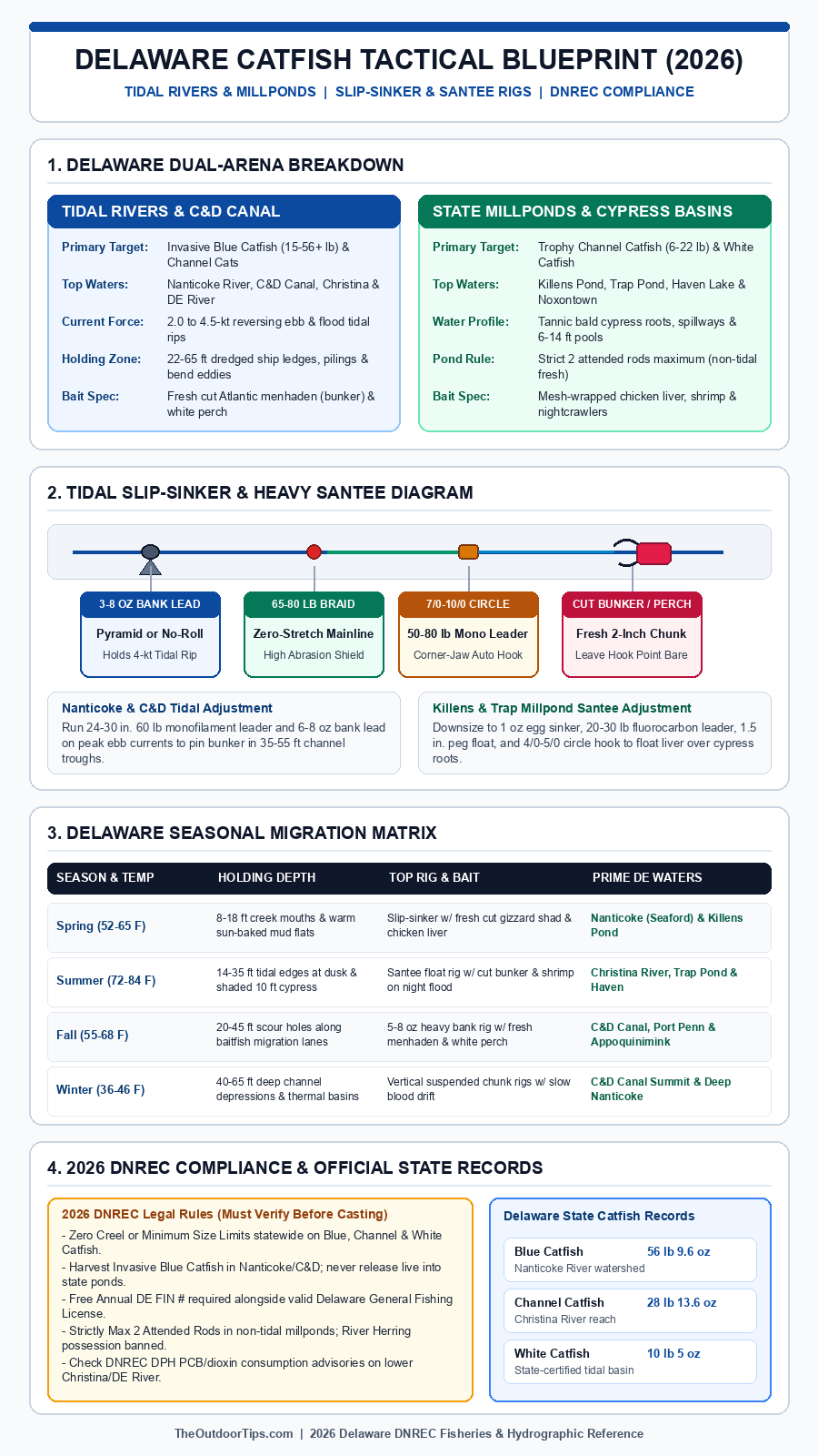
Before trailering a skiff or hauling bank rods down to the marsh, match your rig weight and target species against our side-by-side comparison of all eight premier catfish in delaware fisheries. Notice the sharp divide between heavy tidal sinker waters and lightweight freshwater millpond basins—carrying both setups inside your truck bed ensures a blown-out coastal gale never shuts down your bite.
| Waterway & County | Dominant Species & Weight | Prime Depth & Structure | Top 2026 Rig & Fresh Bait | GPS Launch & Map |
|---|---|---|---|---|
| 1. Nanticoke River & Broad Creek (Sussex) | Blue Catfish (10-56+ lb), Channel Cat | 16-40 ft bends, slack-water creek mouths | 6-8 oz bank sinker, 8/0 circle, fresh bunker | 📍 Map & Ramp (38.5620° N, 75.6610° W) |
| 2. Chesapeake & Delaware (C&D) Canal (New Castle) | Blue Catfish (15-45 lb), Big Channels | 28-62 ft ship-channel shelves & wing dikes | 5-8 oz no-roll lead, 8/0-10/0 circle, cut perch/bunker | 📍 Map & Ramp (39.5590° N, 75.6420° W) |
| 3. Christina River: Newport-Wilmington (New Castle) | Channel Catfish (to 28+ lb), White Cat, Blues | 12-30 ft bridge pilings & bulkheads | 3-5 oz pyramid lead, 6/0 circle, cut menhaden | 📍 Map & Ramp (39.7080° N, 75.6080° W) |
| 4. Delaware River: Augustine Beach-Port Penn (New Castle) | Tidal Blue Cat, Channel Cat, White Catfish | 20-48 ft dike scour & shipping drop-offs | 4-8 oz bank lead, 7/0 circle, oily bunker chunks | 📍 Map & Ramp (39.5060° N, 75.5810° W) |
| 5. Killens Pond State Park (Kent) | Channel Catfish (3-14 lb), Brown Bullhead | 5-11 ft channel depression & spillway tailrace | 1-1.5 oz egg slip, 4/0 circle, liver/shrimp | 📍 Map & Ramp (38.9830° N, 75.5410° W) |
| 6. Trap Pond State Park (Sussex) | Channel Catfish (2-12 lb), White Cat, Bullhead | 5-12 ft submerged bald cypress roots | Santee peg float (1 oz lead), 4/0 circle, clam/liver | 📍 Map & Ramp (38.5260° N, 75.4760° W) |
| 7. Haven Lake & Mispillion Spillway (Kent/Sussex) | Channel Catfish (3-11 lb), White Cat, Bullhead | 6-12 ft dam face & stump basin | 1 oz slip-sinker pond / 2 oz tidal spillway | 📍 Map & Ramp (38.9100° N, 75.4420° W) |
| 8. Appoquinimink River & Noxontown (New Castle) | Channel Catfish, Tidal Blues, White Catfish | 8-24 ft Phragmites marsh bends & dam tail | 2-4 oz bank lead, 5/0 circle, cut gizzard shad | 📍 Map & Ramp (39.4520° N, 75.6540° W) |
1. Nanticoke River & Broad Creek: Seaford to Phillips Landing (Sussex County)
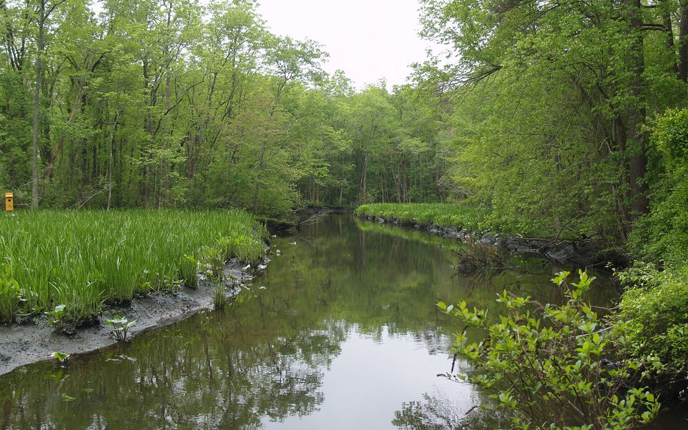
📍 Phillips Landing Boat Ramp, Laurel DE (GPS: 38.5620° N, 75.6610° W)
Spot Water & Access Specs
- Target Species: Blue Catfish (12-56+ lb), Channel Catfish, White Catfish
- Record Potential: State Record Blue Catfish (56 lbs 9.6 oz) caught in the Nanticoke basin
- Productive Depth: 16 to 42 ft outside river bends and Broad Creek scour holes
- Prime Tide Window: Last 90 minutes of outgoing ebb through first 2 hours of incoming flood
- Top Local Baits: Fresh cut Atlantic menhaden (bunker), legal white perch fillets, chicken breast
- Access & Permits: Phillips Landing concrete ramp (DNREC Conservation Access Pass on WMA parking)
Angler Field Log: During an October ebb tide just downstream of Broad Creek’s junction with the mainstem Nanticoke, we dropped two baits along a 29-foot silt ledge inside an outside bend while keeping a third rod tight to a sunken bulkhead eddy in 17 feet. Within forty minutes of full slack turn, our 6-ounce bank lead loaded with fresh-bloodied Atlantic menhaden folded a heavy glass rod clean to the water, producing a 34-pound Blue Catfish with zero slack line warning.
Flowing southwest straight toward Maryland’s Chesapeake Bay tributaries, the Nanticoke River holds the highest biomass of trophy-scale Blue Catfish anywhere within Delaware borders. Originally spreading upriver from established Chesapeake populations, non-native Blues thrive across the Seaford waterfront, Woodland Ferry crossings, and the wide tidal stretch flanking Phillips Landing where Broad Creek dumps stained swamp runoff into the main navigation path. Because freshwater inflow collides twice daily with brackish Chesapeake water, dissolved oxygen and schooling forage stay concentrated along defined channel elbows year-round.
Finding consistent trophy bites along the Nanticoke comes down to reading side-scan sonar along outer bend walls rather than blindly anchoring in dead-flat mid-river water. When the tidal push exceeds two knots between Seaford and Laurel, aggressive twenty- to forty-pound Blues tuck tight behind underwater silt ridges, sunken timber piles, and old marsh-bank slough mouths just out of the heaviest shear. Position your boat or shore cast uphill of a 22- to 36-foot depression so your sinker settles naturally against the lower drop-off shoulder without rolling sideways across mudflats.
From a terminal tackle standpoint, we exclusively run heavy slip-sinker or modified fish-finder rigs on 65-pound braided mainline connected via a high-strength 150-pound barrel swivel to a 24-inch leader of 60-pound abrasion-resistant monofilament. Pair that leader with an 8/0 inline non-offset circle hook baited with a palm-sized chunk of fresh oily menhaden or legal store-bought shad, leaving the hook gap completely exposed. On peak spring and fall spring-tide swings, pack both 5-ounce and 8-ounce pyramid or bank sinkers—anything lighter skips right down the clay shelf and tangles adjacent lines.
Launch logistics at the Phillips Landing Boat Ramp off Phillips Landing Road near Laurel give immediate protection from brisk southwest winds while placing anglers within a ten-minute idle of both Broad Creek bends and main-river holes. Bear in mind that Delaware Wildlife Area parking facilities require a valid DNREC Conservation Access Pass attached to any registered vehicle (unless exempted by holding a valid Delaware hunting or trapping license, or qualifying exemption), and anglers pulling oversized Blue Catfish are strongly encouraged by DNREC biologists to harvest invasive Blues rather than releasing them back—while strictly never transferring live fish into landlocked ponds.
2. Chesapeake & Delaware (C&D) Canal: Summit Bridge to Delaware City (New Castle County)
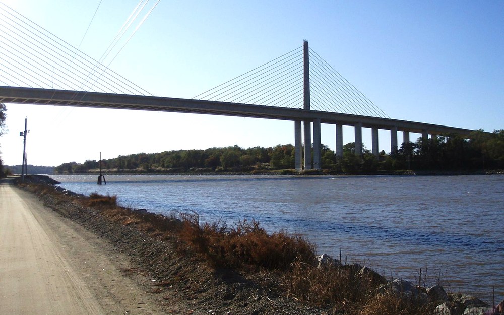
📍 Summit North Marina Boat Ramp, Bear DE (GPS: 39.5590° N, 75.6420° W)
Spot Water & Access Specs
- Target Species: Blue Catfish (15-45+ lb), oversized Tidal Channel Catfish, Striped Bass bycatch
- Channel Profile: 400+ ft wide shipping trench dredged 35-45+ ft deep with steep riprap shelves
- Current Intensity: Extreme 2.5 to 4.5-knot reversing tidal surge connecting Chesapeake & Delaware Bays
- Prime Structure: Submerged rock wing dikes, bridge pier scour eddies, Lums Pond branch ditches
- Heavy Tackle Req.: 6-8 oz no-roll or bank sinkers, 80 lb braid mainline, abrasion shock sleeves
- Public Ramp & Shore: Summit North Marina ramp + armored C&D Canal Mike Castle paved trail shoreline
Angler Field Log: Fished properly around dead-low slack beneath the Summit Bridge approaches, the C&D Canal rewards disciplined bank rigging faster than any northern canal in the Mid-Atlantic. Last November we anchored our sonar mark on the 26-foot step-down shelf just inside an armored riprap cove, running 8-ounce no-roll sinkers behind heavy 80-pound mono leaders. The bite fired like clockwork during the forty-minute current lull before reversing flood tide surged back toward Chesapeake City.
Cut straight across northern New Castle County for fourteen nautical miles between the Delaware River and Back Creek, the Chesapeake & Delaware (C&D) Canal operates as a true heavyweight expressway for migrating catfish in delaware. Massive ocean-going freighters continuously displace water along the 35- to 45-foot navigation trench, pushing disoriented Atlantic menhaden, white perch, gizzard shad, and eels right up against the armored granite riprap shelves lining both north and south banks. Those jagged submerged rock steps harbor winter-fat Blue Catfish and battle-scarred Channel Cats exceeding twenty pounds all twelve months of the year.
Bank anglers enjoy miles of world-class shore access along the paved Michael N. Castle Trail running parallel to the water from Summit North down through St. Georges and Delaware City, whereas boat captains launching out of Summit North Marina or Reedy Point must respect strict shipping etiquette. Never drop anchor inside the central barge fairway, and always watch both AIS traffic and massive tanker wakes capable of washing right over low-freeboard jon boats. Instead, tuck safely into the back-eddy pockets around submerged rock jetties, cove entrances, and bridge abutment shoulders in 18 to 32 feet.
Terminal survivability separates landed trophies from shredded snap-offs along these granite canal boulders. Swap standard light mono mainlines for 65- to 80-pound hollow or 8-carrier braided line, add a heavy 18-inch 80-pound monofilament leader, and run no-roll flat sinkers or coin weights rather than round egg sinkers that tumble relentlessly through jagged riprap crevices. Our go-to canal bait remains fresh butterflied white perch head or a thick bloody belly section of Atlantic menhaden rigged on a forged 8/0 circle hook—scent plumes travel rapidly through brisk brackish canal water.
Pay close attention to wind direction relative to the canal tide cycle before leaving the truck. When a twenty-knot east wind blows directly against an outgoing eastbound current, standing two-foot chop builds steep and wet within minutes—making sheltered shoreline casting behind the Summit Bridge pilings or Reedy Point dike pocket far safer and more productive than hovering in exposed open water. Check both Lums Pond access parking lots and Delaware City bulkhead rules for seasonal dusk-to-dawn trail regulations.
3. Christina River & White Clay Creek Confluence: Newport to Wilmington (New Castle County)
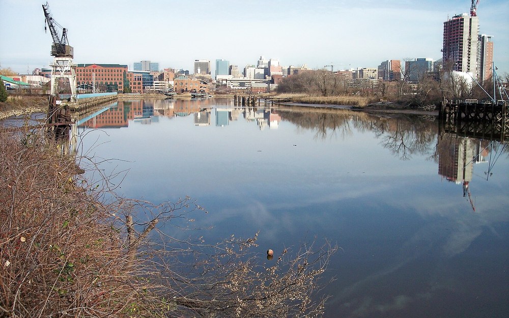
📍 Newport Boat Ramp Christina River, Newport DE (GPS: 39.7080° N, 75.6080° W)
Spot Water & Access Specs
- Target Species: Trophy Channel Catfish (state record 28 lb 13.6 oz), Blue Catfish, White Catfish
- Confluence Zones: White Clay Creek junction (Churchmans Marsh) down to Brandywine mouth
- Water Profile: Sluggish mud-bottom tidal bends, sunken pier pilings, warm culvert outflows
- Top Local Baits: Fresh cut menhaden, chicken liver tied in spawn mesh, nightcrawlers, dip baits
- Access Logistics: Newport Boat Ramp (John St.) + Wilmington Riverfront & Peterson Marsh access
- Health Advisory: Check DNREC/DPH PCB & dioxin advisories; strict catch-and-release advised
Angler Field Log: Running our skiff downriver from Newport Boat Ramp toward the Route 141 and I-95 bridge bends late on a humid June evening, we bypassed the skinny five-foot flats and set four rods around an eighteen-foot outside piling cluster below a warm-water drainage eddy. While small White Catfish pecked at worms in shallow water, a weighted 5/0 circle rig packed with bloody gizzard shad drew two thick 14-pound Channel Catfish back-to-back as outgoing tide picked up speed.
Winding cleanly past suburban marshes near Newport before threading directly beneath Wilmington’s steel bridges toward the Delaware River, the tidal Christina River holds deep pedigree as the historic birthplace of Delaware’s state-record Channel Catfish at 28 pounds, 13.6 ounces. Upstream of the Brandywine River confluence, White Clay Creek merges with Red Clay Creek to pump nutrient-dense organic silt into Churchmans Marsh, turning miles of mud-bank bends into a rich invertebrate and baitfish pantry. Warm summer evenings consistently awaken double-digit Channels and aggressive migrating Blues patrolling beneath rotting timber pilings.
From the public Newport Boat Ramp off Water Street / Route 4, small aluminum rigs and pedal kayaks can cover both shallow upriver oxbows toward Smalley’s Pond dam and deeper lower reaches holding 18 to 30 feet of tea-colored tidal flow. Focus your casts directly around shaded bridge fenders, sunken wooden cribbing, and storm-drain discharge mouths after heavy summer rainstorms wash earthworms and stunned shiners into the channel. During cool March mornings, shallow mud flats along the northern bank absorb afternoon sunlight rapidly, pulling lethargic pre-spawn catfish out of cold mainstem troughs.
Standard heavy-river gear is overkill upstream around Newport, where 3- to 5-ounce bank sinkers easily pin baits on muddy bends when currents average one to two knots. Rig a medium-heavy 7-foot-6 catfish rod with 30-pound high-visibility monofilament or 50-pound braid backing into a 40-pound fluorocarbon leader and 6/0 inline circle hook. If relentless blue crabs or mud turtles strip fragile chicken liver within minutes during brackish late-summer low water, switch immediately to tough cut white perch belly or leathery squid strips pinned firmly to the shank.
Mandatory Field Ethics & Consumption Notice: Because the lower industrial corridor from Newport down through Wilmington and the Brandywine mouth carries legacy industrial sediment contamination, always review current Delaware DNREC and Division of Public Health (DPH) fish consumption advisories for PCBs and dioxins before retaining any bottom-feeding species here. Treat the urban Christina River as a premier catch-and-release trophy photography fishery—bring a padded unhooking mat, wet hands for quick scale shots, and revive every mature spawner cleanly beside the boat.
4. Delaware River Tidal Mainstem: Augustine Beach to Port Penn & Reedy Island (New Castle County)
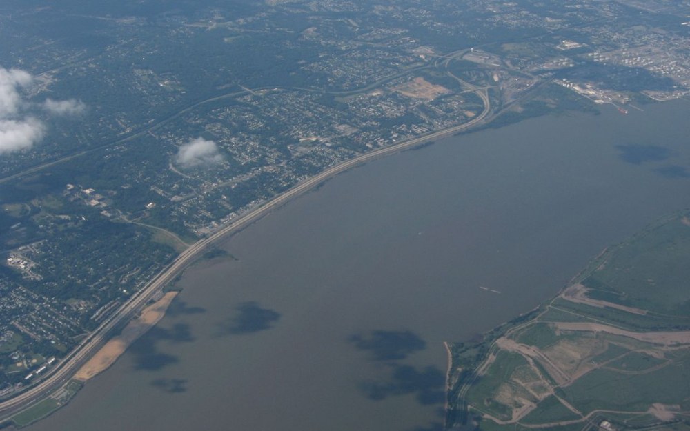
📍 Augustine Beach State Boat Ramp, Port Penn DE (GPS: 39.5060° N, 75.5810° W)
Spot Water & Access Specs
- Target Species: Big Tidal Blue Catfish, Channel Catfish, brackish White Catfish
- Water Profile: Massive tidal river estuary transitioning from fresh/brackish down to bay salinity
- Key Structure: Reedy Island rock dike edges, channel buoy drops (22-48 ft), creek mouths
- Top Local Baits: Fresh cut bunker (Atlantic menhaden), mullet chunks, bloodworms for Whites
- Ramp & Access: Augustine Beach State Boat Ramp (Port Penn); sheltered cove + concrete lanes
- Safety & Advisories: Strong tidal winds/tanker wakes + check DNREC DPH advisories north of Pea Patch
Angler Field Log: Whenever brisk summer heat drives baitfish out into deep oxygenated mainstem channels below Delaware City, we trailered straight down Route 9 to Augustine Beach. Positioning along the outer shoulder of the Reedy Island stone dike in 24 feet of rolling tide just ahead of sunset, 5-ounce pyramid leads kept fresh cut bunker anchored firmly through three-knot cross-currents, producing steady 10- to 24-pound Blues plus surprisingly chunky White Catfish between striped bass blitzes.
Just south of Pea Patch Island and the eastern outlet of the C&D Canal, the mighty Delaware River widens dramatically past Port Penn and Augustine Beach before opening toward the upper Delaware Bay. While saltwater anglers routinely target summer weakfish and striped bass through this zone, sharp catfish captains know that brackish salinity tolerances allow chunky Channel Catfish, oversized White Catfish, and opportunistic Blue Catfish to cruise miles of fertile mussel beds and mud shelves along the Delaware shoreline—especially following wet spring rainfall surges that push the salt line seaward.
The concrete multi-lane ramps inside the protected stone jetty at Augustine Beach provide the safest modern launch point along the lower New Castle County coast, keeping bank fishermen near armored shoreline rocks while putting trailered bay boats within five minutes of Reedy Island’s storied sunken rock dike. Rather than running blindly into the forty-foot commercial tanker fairway, trace your electronics along the 15- to 28-foot shelf where shallow mud flats drop sharply into deep eddies trailing Reedy Point, Appoquinimink Creek’s mouth, and Duck Creek edges.
Current velocity and crab interference dictate both your terminal weight and bait choices on the main river. Pack sturdy eight-foot heavy-action rods loaded with 50- to 65-pound braid, 5- to 8-ounce bank or frog-tongue sinkers capable of biting into slick bottom clay, and stiff 60-pound monofilament leaders terminating in 7/0 inline circle hooks. When pesky blue crabs demolish soft fish fillets on warm August nights, switch to tough menhaden head sections wrapped tightly with elastic bait thread or fresh clam tongues dipped in menhaden oil.
Always treat mainstem estuary winds with deep respect before pulling clear of the Augustine Beach breakwater: a steady fifteen-knot southeaster blowing squarely against a falling ebb builds steep four-foot whitecaps rapidly across shallow flats. Check NOAA marine forecasts first, wear USCG-approved PFDs at all times under way, carry your required free Delaware FIN number alongside your fishing license, and review DNREC’s current upper-river PCB/dioxin consumption charts prior to boxing any fish caught near industrial reaches.
5. Killens Pond State Park & Murderkill River Impoundment (Kent County)
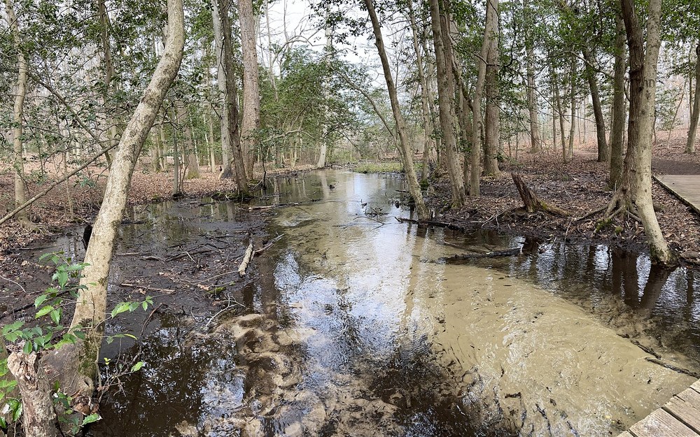
📍 Killens Pond State Park Boat Launch, Felton DE (GPS: 38.9830° N, 75.5410° W)
Spot Water & Access Specs
- Target Species: Channel Catfish (3-14 lb), Brown Bullhead (2-4+ lb), White Catfish
- Acreage & Depth: 66-acre historic Murderkill millpond averaging 5-10 ft; spillway plunge pool below
- Prime Structure: Old submerged river channel cut, spatterdock lily edges, spillway tailwater
- Legal Rod Cap: Strictly MAX 2 attended rods per angler in non-tidal Delaware freshwaters
- Top Baits: Chicken liver in elastic mesh, nightcrawlers, peeled shrimp, punch dip baits
- Park Fees & Rules: DE State Park daily entry fee in-season; electric trolling motors / paddles only
Angler Field Log: Easing a quiet kayak out past the Killens Pond launch just before dusk in late May, we anchored right off the narrow submerged Murderkill Creek bend where water depth dropped cleanly from four feet down into nine. With Delaware’s non-tidal two-rod cap enforced, we staggered one Carolina-rigged chicken liver beside a shallow cork-suspended nightcrawler along the edge of emerging lily pads—both lines stayed bent with four- to nine-pound Channel Catfish until midnight.
Anchoring central Kent County roughly twelve miles south of Dover, Killens Pond State Park dammed the upper Murderkill River centuries ago to create a classic 66-acre Delmarva millpond tailor-made for accessible freshwater delaware catfishing. Unlike roaring brackish rivers that demand eight-ounce surf leads and heavy bay boats, Killens Pond surrounds anglers with tranquil wooded coves, spatterdock beds, shallow submerged timber stumps, and a concrete public boat ramp restricted strictly to kayaks, canoes, and quiet electric-motor skiffs—meaning big Channel Catfish roam shallow flats completely unbothered by wake-boat traffic.
Although much of the basin sits uniformly between four and seven feet deep, diligent kayak or john-boat anglers quickly locate the original winding Murderkill channel groove etched across the southern half of the pond, dropping subtly to nine or eleven feet near the main concrete dam. On blazing July afternoons, schools of three- to ten-pound Channel Cats rest quietly along those cooler floor depressions before pushing into three-foot feeder creek channels and shoreline lily pad pockets as soon as shadows lengthen over the canopy.
Shore anglers without watercraft hold an equally potent card directly below the Killens Pond Spillway off Killens Pond Road, where water spills continuously into the upper Murderkill River channel. That aerated plunge pool concentrates hungry Channel Catfish, White Catfish, and chunky Brown Bullheads feeding aggressively on stunned baitfish tumbled over the weir. Run streamlined 3/4-ounce to 1.5-ounce egg slip-sinkers above a glass bead, 18-inch 20-pound fluorocarbon leader, and 4/0 inline circle hook dressed with raw peeled shrimp or chicken liver held fast inside stretchy bait-spawn netting.
Remember Delaware’s non-tidal freshwater rules before unstrapping extra rod holders: every angler fishing Killens Pond above the spillway is strictly limited to two attended fishing rods (or hand lines) simultaneously, and every resident or visitor needs both a valid Delaware freshwater fishing license and a free annual Delaware FIN number. Check current Delaware State Park seasonal day-use entry fees at the Felton gatehouse and keep an eye on park closing hours unless camping overnight inside park grounds.
6. Trap Pond State Park & Bald Cypress Basin (Sussex County)
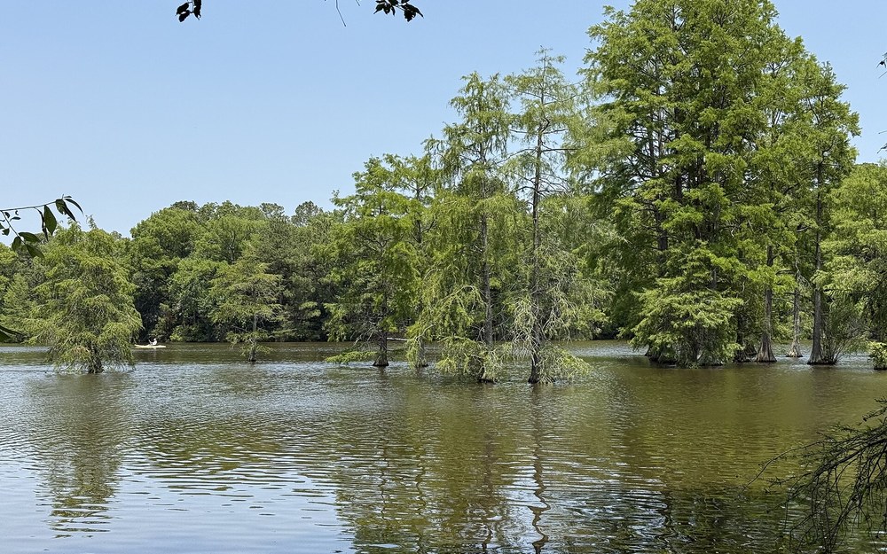
📍 Trap Pond State Park Boat Ramp, Laurel DE (GPS: 38.5260° N, 75.4760° W)
Spot Water & Access Specs
- Target Species: Channel Catfish (3-12 lb), White Catfish, Yellow & Brown Bullheads
- Acreage & Habitat: 90-acre darkwater impoundment hosting northernmost natural bald cypress stand
- Prime Structure: Hollowed cypress root buttresses, submerged cypress knees, James Branch inflow
- Top Local Rig: Weedless Santee peg-float rig keeping cut bait 12-18 in. off cypress muck
- Best Baits: Cut shiners, nightcrawlers, peeled raw shrimp, hotdog chunks soaked in garlic
- Access & Limits: Public boat ramp & kayak launch; electric motors only; max 2 rods non-tidal
Angler Field Log: Toss an unfloated bottom sinker straight into Trap Pond’s tangled bald cypress roots and you’ll lose three hooks before spotting a single fin. Instead, we clipped bright 1.5-inch chartreuse peg floats onto 25-pound mono leaders twelve inches ahead of 4/0 octopus circle hooks baited with fresh cut sunfish strips. Pitching lightly between flooded cypress knees off the eastern island coves yielded nine scrappy Channel and White Catfish in three sunny morning hours.
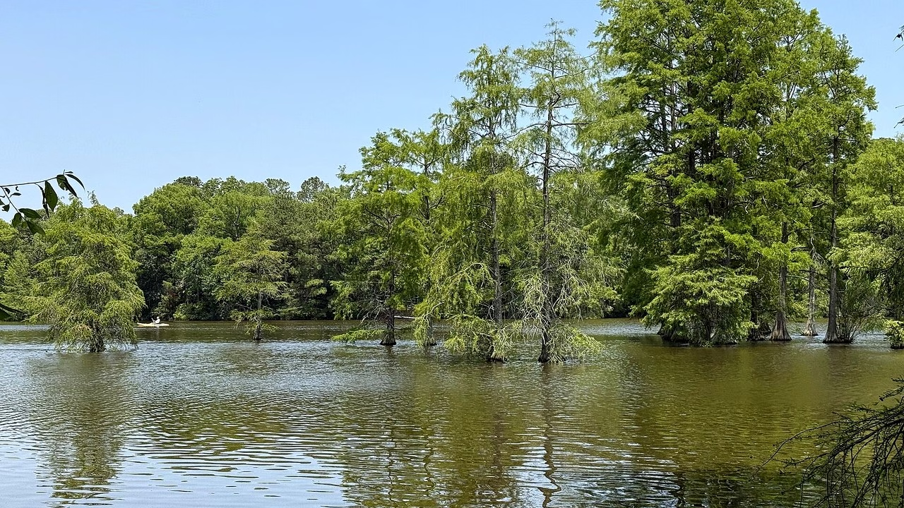
Paddling silently beneath ancient moss-draped trunks at Trap Pond State Park near Laurel feels closer to southern Louisiana bayous than the Mid-Atlantic seaboard, yet this protected 90-acre millpond stands as one of the cleanest, most atmospheric settings for targeting freshwater catfish in delaware. Protecting the northernmost naturally occurring stand of bald cypress in the United States, Trap Pond stains naturally dark with fallen cypress needles and cedar tannins—keeping light penetration low so skittish Channel Catfish and bullheads feed comfortably well past sunrise.
Flooded cypress knees, fallen timber crowns, and dense aquatic pads across the upper James Branch inflow and connecting cove behind Baldcypress Trail provide ideal ambush cover, though that exact labyrinth destroys standard heavy bottom rigs within minutes. To keep terminal gear fishing rather than hung solid in submerged driftwood, switch entirely to lightweight Santee Cooper float rigs: thread a 3/4-ounce egg sinker onto 30-pound braid, tie a small rolling swivel, add a 16- to 20-inch 25-pound monofilament leader, and peg a small cigar cork six inches behind a 4/0 hook so baits hover cleanly above leafy bottom silt.
If daytime boat rentals and weekend paddlers stay concentrated near the main beach and public fishing pier, launch early via the Trap Pond boat ramp with a quiet electric trolling motor or pedal kayak and work upriver toward the narrow timber channel leading toward Trussum Pond. Even shallow four-foot water sheltered inside shaded cypress canopy stays cooler and more oxygenated through August dog days than exposed pond centers, making slow vertical drops right along buttressed tree trunks devastatingly effective.
Strict Delaware freshwater governance governs both Trap Pond and neighboring Trussum Pond: obey the statewide non-tidal maximum of two attended rods per angler, respect the strict state prohibition against possessing or using river herring as bait, and display your seasonal Delaware State Park pass on any parked vehicle. Because DNREC strictly bans moving live aquatic species between waters, never transport caught Nanticoke Blue Catfish here—keep Trap Pond’s pristine cypress balance intact.
7. Haven Lake & Mispillion River Spillway: Milford Reach (Kent & Sussex Counties)
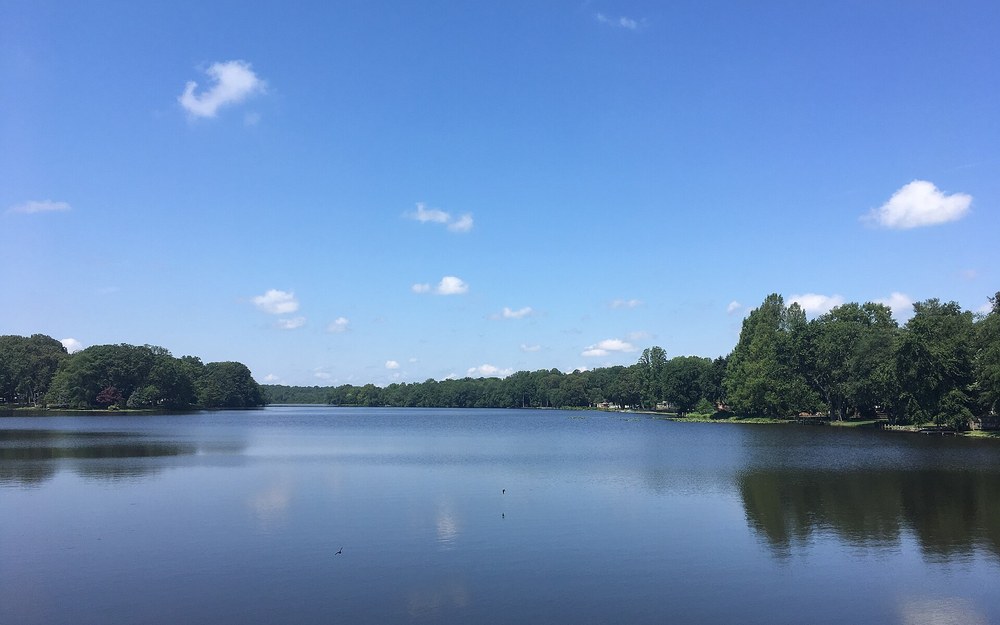
📍 Haven Lake State Boat Ramp, Milford DE (GPS: 38.9100° N, 75.4420° W)
Spot Water & Access Specs
- Target Species: Channel Catfish (3-11 lb), White Catfish, Brown Bullhead
- Water Dual-Zone: 70-acre freshwater pond above the Lakeview Ave dam; tidal Mispillion River below
- Prime Structure: Stump fields along western bend, submerged spillway apron, shaded marsh edges
- Rig Strategy: 1 oz egg slip-sinker above dam; 2 oz pyramid bank rig below tidal outfall
- Top Local Baits: Raw shrimp, stink/punch dip baits, fresh white perch strips, nightcrawlers
- Launch Logistics: DNREC Haven Lake Boat Ramp off Lakeview Ave (Milford); small motor friendly
Angler Field Log: Straddling the Kent-Sussex line right inside Milford, Haven Lake gave us an unbeatable two-front pattern during warm late-summer afternoons. We first soaked light 1-ounce shrimp rigs along the six-foot stump line upstream of the boat ramp for eager four-pound White and Channel Cats, then walked thirty yards downstream below the Lakeview Avenue spillway where incoming Mispillion tide pushes fresh baitfish right up against the swirling dam wall.
Tucked cleanly along the historic Milford millpond chain alongside Silver Lake and Griffith Lake, Haven Lake bridges central Kent and northern Sussex counties with 70 acres of under-pressured darkwater habitat and a remarkably accessible public boat ramp right off Lakeview Avenue. Originally impounded along headwaters feeding the Mispillion River toward Delaware Bay, Haven Lake remains shallow overall—mostly four to nine feet with scattered eleven-foot scour basins near the eastern dam face—meaning warm spring sunshine sparks catfish activity weeks ahead of deeper northern piedmont quarries.
On the calm freshwater side above the dam, smooth shorelines and wide timber-lined pockets allow effortless shore casting or gentle trolling-motor drifts using low-horsepower outboard or electric craft. Stump fields lingering near the western bends where Abbotts Mill Branch enters the pond serve as reliable daytime holding pens; fan-cast a split pair of medium-action seven-foot rods tipped with store-bought peeled shrimp or stink-bait sponges across stump shadows while keeping drag loose enough for fish to run cleanly.
Walk or trailer just minutes below the dam structure, however, and you drop directly into the brackish tidal head of the Mispillion River, completely changing your fishing playbook. Twice daily, salty Bay tide pushes brackish forage, white perch, and small eels straight to the base of the Milford spillway apron before draining back down past marshy channels toward Cedar Creek. Anchor two-ounce bank sinkers right along the rocky current seam trailing the concrete discharge—when twilight settles over the weir, chunky tidal Channel Cats and White Catfish crowd dangerously close to shore.
Keep clear track of precisely which side of the dam your baits rest on regarding local rules: Delaware’s strict two-rod non-tidal ceiling applies cleanly across Haven Lake and upper Silver/Griffith impoundments, whereas the lower tidal Mispillion requires careful adherence to your active DE FIN number alongside standard coastal license rules. Parking at the state ramp off Lakeview Avenue remains free for licensed trailers and single cars, making Haven Lake a clutch quick-strike after-work destination.
8. Appoquinimink River & Noxontown Pond Corridor: Odessa to Route 9 (New Castle County)
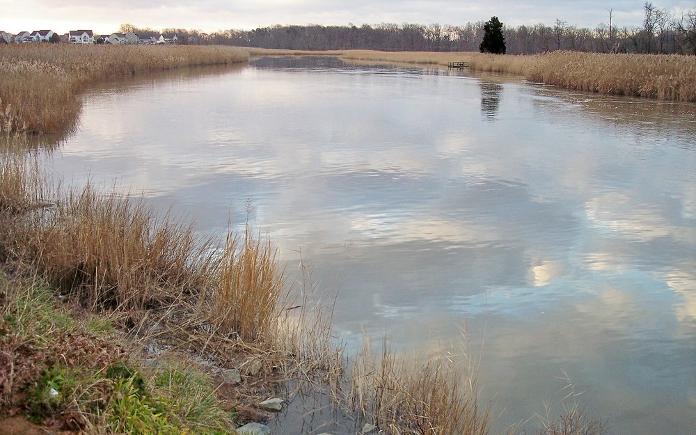
📍 Odessa Boat Ramp Appoquinimink River, Odessa DE (GPS: 39.4520° N, 75.6540° W)
Spot Water & Access Specs
- Target Species: Channel Catfish (3-18 lb), invading Tidal Blue Catfish, White Catfish
- Two-Stage Corridor: Freshwater Noxontown Pond (~160 acres) above dam; tidal river below Odessa
- Prime Structure: Phragmites marsh creek junctions, Route 299 bridge pilings, mud bend cuts
- Top Local Rigs: 2-4 oz bank slip-sinker on tidal curves; 1 oz Santee float inside Noxontown
- Top Local Baits: Fresh cut gizzard shad, cut bunker, grass shrimp, chicken liver
- Public Ramps: Odessa State Boat Ramp (Mechanic St.) + Noxontown Pond state ramp (Route 13)
Angler Field Log: Launching our shallow aluminum skiff at the Odessa State Boat Ramp two hours ahead of dead low tide, we slipped past the Route 299 bridge fenders and anchored alongside the first sharp Phragmites creek mouth bleeding warm mud-flat runoff back into the river. Soaking 3-ounce flat leads packed with fresh white perch chunks right along the fourteen-foot outer channel edge produced six chunky Channel Catfish plus an aggressive 13-pound Blue Cat before dark.
Tucked gracefully into southern New Castle County just below the C&D Canal, the Appoquinimink River and Noxontown Pond corridor delivers one of Delaware’s best two-part escapist catfish trips away from concrete container ports and speeding highway bridges. Above the spillway along Noxontown Road lies tranquil Noxontown Pond, roughly 160 acres of winding drowned timber, deep weed edges, and shaded creek arms feeding healthy populations of Channel Catfish, White Catfish, and oversized bullheads across calm non-tidal waters.
Drop immediately downstream of Noxontown Dam past Route 299 toward the historic town of Odessa, and the creek widens dramatically into the winding tidal Appoquinimink River slicing through miles of golden Phragmites marshland all the way to the Delaware Bay. That continuous tidal flushing creates razor-sharp silt cutbanks, ten- to twenty-four-foot bridge scour holes, and dozens of feeder marsh guts that funnel hungry blue crabs, grass shrimp, and young-of-the-year menhaden right past waiting whiskers twice every twenty-four hours.
Launching via the state Odessa Boat Ramp right off Mechanic Street grants clean, sheltered concrete access for trailered jon boats and sea-worthy fishing kayaks—always watch extreme low spring tides so you don’t trim mud on steep ramp drop-offs. Work systematically along outside marsh curves where fast muddy tide carves steeper bank undercuts, holding baits cleanly on two- to four-ounce no-roll sinkers rigged on 50-pound braid. Should ferocious mid-day tidal currents slacken or brackish winds kick up too steeply around Route 9, simply pull up the ramp and drive five minutes west to launch on calm freshwater Noxontown Pond under two-rod pond rules.
Notice one subtle seasonal trick locals guard carefully along this corridor: whenever warm spring rains swell water flowing fast over Noxontown Pond’s earthen dam tailwater, schoolie Channel Catfish pack cheek-to-jowl into the fresh oxygenated plunge basin waiting for stunned bluegill and gizzard shad washed downstream. Always keep fresh non-herring baits handy and obey all DNREC ramp signage and tidal FIN registration requirements before casting into either half of the watershed.
Delaware Catfish Species Breakdown & 2026 Terminal Rig Blueprint
Positively identifying every whiskerfish sliding over your gunwale matters more in Delaware than almost any neighboring state—primarily because DNREC fisheries managers explicitly urge anglers to harvest invasive Blue Catfish (Ictalurus furcatus) across tidal Bay and Nanticoke watersheds while protecting clean native fish balances elsewhere. Misidentifying a chunky pale ten-pound Channel Catfish for a Blue Catfish is an everyday mistake along stained tidal water unless you immediately count the rays along the bottom anal fin.
- Blue Catfish (State Record: 56 lbs 9.6 oz — Nanticoke River): Features a bright silvery-blue to slate-gray back, pure bright white belly with zero dark body spots, and a flat, straight-edged anal fin housing 30 to 36 distinct soft rays. Invasive in Delaware coastal watersheds and grows past 50+ lbs across the Nanticoke, C&D Canal, and Delaware River.
- Channel Catfish (State Record: 28 lbs 13.6 oz — Christina River): Exhibits olive-slate sides (younger fish carry crisp black scatter spots; old breeding males turn solid dark blue-gray with swollen heads), a deeply forked tail, and a rounded curved anal fin displaying 24 to 29 rays. Abundant statewide in both tidal channels and Kent/Sussex millponds.
- White Catfish (State Record: 10 lbs 5 oz): Stout, shorter-bodied tidal native bearing a wide flat head, shorter white chin barbels, and a distinctly moderately forked tail with rounded lobes (never deeply V-notched like Blues or Channels). Very common across Haven Lake, lower Nanticoke, and brackish Christina waters.
- Brown & Yellow Bullheads: Compact dark-green to butter-belly natives identified cleanly by their squared-off, un-forked broom tails. Flourish inside Trap Pond, Killens Pond, and shallow warm millpond weed beds on simple nightcrawler or liver setups.
Watch Our Tidal & Millpond Catfish Slip-Sinker Rigging Field Demonstration
Before dropping heavy leads into four-knot C&D Canal tides or floating bait above Trap Pond cypress roots, study exact leader lengths, sinker-slide positioning, and knot tension in this on-the-water rigging breakdown designed for mixed current conditions.
Field-Tested Tackle Loadouts for Delaware Tidal Channels & Millponds
Trying to haul a forty-pound Nanticoke Blue Catfish out of a twenty-foot logjam on panfish spinning tackle ends identically every time—a straightened snap swivel or parted braid knot. Conversely, lobbing stiff broomstick surf rods into Trap Pond’s shaded coves strips away sensitivity when delicate bullheads and Channel Cats mouth lightly. Dial in these three proven category setups tuned directly around Delaware’s dual fisheries:
1. Heavy Tidal River Rod
Spec: 7’6″ to 8’0″ Heavy / Moderate-Fast Composite Blank (rated 4–12 oz lead, 20–60 lb line).
Absorbs ferocious tanker wakes and heavy current bend along the C&D Canal and Delaware River while still loading steadily on inline circle hooks so trophy Blues never drop bait prematurely.
2. High-Capacity Line & Reel
Spec: 6000-Size Baitrunner or 6500 Round Levelwind Reel + 65 lb 8-Carrier Braid Mainline.
Deep 250+ yard capacity prevents roaring outgoing current loops from stripping your spool bare, while crisp clicker alarms let river giants swim five yards before you crank smoothly into corner-jaw hookups.
3. Terminal Hook & Lead Kit
Spec: 4/0–8/0 Non-Offset Inline Circle Hooks, Santee Peg Floats & 1–8 oz No-Roll / Bank Leads.
Switch effortlessly from heavy flat bank sinkers pinning cut menhaden on coastal gravel channels to 1.5-inch buoyant corks lifting fresh shrimp above cypress root crowns in southern millponds.
Delaware Seasonal Hydrology & Bite Windows
Water temperature and tidal river runoff dictate daily catfish positioning far more reliably than calendar dates along coastal Delmarva. Understanding when warming shallows wake spring millponds versus when cooling autumn baitfish draw heavyweight Blues into deep shipping channels keeps rods steadily bent across all four seasons.
| Season & Water Temp | Where Catfish Hold in Delaware | Highest-Percentage Presentation | Top Delaware Destination |
|---|---|---|---|
| Spring (52-65°F) | Shallow 6-15 ft dark-mud sun flats and warm feeder creek mouths | Lighter 2-3 oz slip-sinkers w/ fresh cut gizzard shad & nightcrawlers | Nanticoke River (Seaford) & Killens Pond |
| Summer (72-84°F) | 14-35 ft tidal edges at night flood; 8-12 ft shaded cypress timber by day | Santee peg floats w/ chicken liver, shrimp & fresh cut menhaden after dusk | Trap Pond, Haven Lake & Christina River |
| Fall (55-68°F) | 20-45 ft river bends & riprap ditches staging outbound mullet/bunker schools | Heavy 5-8 oz no-roll or bank sinkers w/ large bloody bunker chunks | C&D Canal, Port Penn & Appoquinimink |
| Winter (36-46°F) | 40-65 ft deep channel depressions & slow thermal bottom pockets | Stationary vertical chunk rigs held directly beneath anchored sonar marks | C&D Canal Summit Trench & Deep Nanticoke |
2026 Delaware DNREC Regulations, FIN Registration & Consumption Safety
Verify all current regulations on the official Delaware Division of Fish and Wildlife (DNREC) portal prior to launching or filling a cooler—rules differ sharply between tidal rivers and state-managed freshwater millponds:
- No Creel or Minimum Size Limits: Statewide, Delaware enforces zero daily creel limit and zero minimum size limit on Blue, Channel, and White Catfish as well as Bullheads. In fact, DNREC actively encourages anglers to harvest invasive Blue Catfish caught in the Nanticoke, C&D Canal, and Delaware River drainages—and strictly prohibits transporting or releasing live fish into uninfested state millponds.
- Mandatory Free Annual DE FIN #: Almost every angler age 16+ (including exempted seniors 65+ and tidal saltwater anglers) must obtain a free annual Delaware Fisherman Information Network (FIN) number before wet-testing any bait, alongside an active Delaware General Fishing License.
- Strictly Max 2 Rods in Non-Tidal Freshwaters: When fishing Killens Pond, Trap Pond, Haven Lake above the dam, or Noxontown Pond, state law caps each angler at two attended fishing rods (or hand lines) simultaneously. Open tidal waters carry no statewide two-rod limit unless posted locally.
- Strict River Herring Possession Ban: Taking, possessing, or cutting up alewives or blueback river herring as catfish bait is strictly illegal across Delaware freshwaters and tidal rivers. Stick strictly to legal marine Atlantic menhaden (bunker), legal-sized white perch, store-bought gizzard shad, chicken liver, or raw shrimp.
- Access Fees & PCB Consumption Advisories: Delaware State Parks (Killens & Trap) charge seasonal daily entry fees; DNREC Wildlife Area ramps (like Phillips Landing) require a Conservation Access Pass on vehicles unless exempt. Always verify current DNREC/DPH PCB & dioxin consumption advisories before eating bottom-dwelling fish harvested from the urban lower Christina River, Brandywine River, or upper Delaware River.
Dial In Your Rigging Numbers With Our Interactive Fishing Calculators
Guessing lead weights against four-knot C&D Canal current loops or misjudging how much 65-pound braid actually fits onto a 6000-size baitrunner costs both lost terminal tackle and busted trophies. Lock in exact line diameters, knot pairings, and bite windows before pulling out of the ramp:
River Sinker Weight Calculator
Calculate exact ounce lead ratings needed to hold bottom cleanly across 1 to 4.5-knot Delaware tidal rivers and dam tailraces.
Reel Line Capacity Calculator
Verify exact yardage when backing monofilament beneath 50–80 lb braided mainlines on spinning and round baitcasting spools.
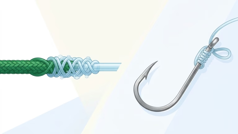
Knot Strength & Line Matcher
Pair slick braided mainlines to stiff 60–80 lb monofilament shock leaders without losing 30% break strength at the swivel.
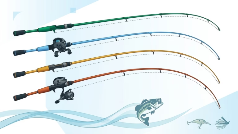
Rod Power & Action Matcher
Match your casting blank power, length, and tip flex to either 8-oz tidal bunker chunks or delicate 1-oz Santee pond floats.
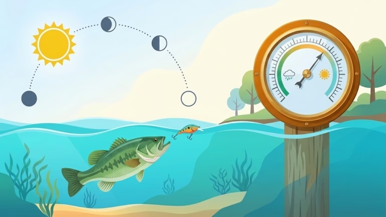
Solunar & Barometric Timer
Stack overhead moon-transit peaks and falling summer barometric fronts right on top of Nanticoke and Port Penn tide tables.
Complete Catfish Bait Guide
Compare fresh menhaden cut-bait oil dispersion, white perch durability, and crab-resistant coastal wrapping techniques.
Final Captain’s Verdict: Picking Your Ideal 2026 Delaware Catfish Run
After logging tide swings and darkwater evening drifts across every corner of Delaware, choosing among the best catfish fishing spots in delaware comes down cleanly to whether you crave heavy line-peeling coastal monsters or serene backwater action under two attended rods:
- For Heavyweight Record-Class Blue Catfish: Launch at Phillips Landing on the Nanticoke River during slack-to-flood current turns or anchor off the C&D Canal shelves with 6–8 oz leads and fresh bloody menhaden chunks. Harvest your invasive Blues cleanly to help local forage stocks.
- For Urban Trophy Channel Catfish: Work the bridge pilings and creek junctions along the Christina River downstream of Newport Boat Ramp with strict catch-and-release photography practices.
- For Calm Kayaking & Family Bank Trips: Pack light 1-ounce Santee peg floats, chicken liver mesh, and raw shrimp for Trap Pond State Park’s bald cypress basin, Killens Pond, or Haven Lake in Milford—honoring Delaware’s non-tidal two-rod cap and free annual FIN registration on every outing.
Delaware Catfishing FAQs: Licenses, Invasive Blues & Rigging
Do I need a special license or FIN number to fish for catfish in Delaware in 2026?
Yes. Every non-exempt angler aged 16 and older needs a valid Delaware General Fishing License plus a mandatory free annual Delaware Fisherman Information Network (FIN) registration number. Note that Delaware seniors aged 65+ and tidal saltwater anglers must still carry an active free annual FIN number prior to fishing tidal or coastal rivers like the Nanticoke, C&D Canal, and Christina.
What is the daily creel limit and minimum size limit for catfish in Delaware?
Statewide in Delaware, there is NO minimum size limit and NO daily creel limit on Blue Catfish, Channel Catfish, White Catfish, or Bullheads. DNREC fisheries managers actually encourage anglers to harvest invasive Blue Catfish caught in the Nanticoke River, C&D Canal, and Delaware River watersheds rather than releasing them, while strictly forbidding transporting live catfish into any public state millpond.
How many fishing rods can I use at once when catfishing in Delaware?
In non-tidal freshwater ponds and lakes (including Killens Pond, Trap Pond, Haven Lake above the dam, and Noxontown Pond), Delaware law strictly limits each angler to a maximum of TWO attended fishing rods or lines. Tidal waterways like the Nanticoke River, C&D Canal, Appoquinimink River, and Delaware River do not carry a strict statewide two-rod cap unless specifically posted at a local access site.
Where was the largest Blue Catfish caught in Delaware?
Delaware’s official state-record Blue Catfish weighed an astonishing 56 pounds, 9.6 ounces and was landed inside the Nanticoke River watershed in Sussex County. The state-record Channel Catfish weighed 28 pounds, 13.6 ounces and was caught in the tidal Christina River corridor in New Castle County.
Is river herring legal to use as cut catfish bait in Delaware?
No. Taking, possessing, or using river herring (alewives or blueback herring) as bait is strictly prohibited across Delaware freshwaters and tidal rivers. Stick exclusively to legal marine Atlantic menhaden (bunker), legal-sized white perch, store-bought gizzard shad, raw peeled shrimp, nightcrawlers, or chicken liver wrapped in mesh.
What weight sinker should I carry for the C&D Canal and Nanticoke River?
During mild slack water transitions, 3- to 4-ounce bank or no-roll leads will hold bottom smoothly. However, once mid-ebb or flood tidal currents roar up to 3–4.5 knots along main shipping shelves in the C&D Canal or Port Penn, you must step up to 6- to 8-ounce no-roll flat sinkers or pyramid leads paired with zero-stretch 65–80 lb braided line.
Are catfish caught in the Christina River and Delaware River safe to eat?
Check the latest Delaware DNREC and Division of Public Health (DPH) fish consumption advisories before keeping any bottom-feeding fish from industrial reaches. Urban stretches of the lower Christina River, Brandywine River, and upper tidal Delaware River carry strict PCB and dioxin consumption advisories—practice catch-and-release photography on those sections while saving harvest trips for cleaner Nanticoke River or rural Sussex/Kent millponds.