In our summer tidal river drift logs anchoring heavy 5-ounce pyramid weights along the deep channel bend outside Haddam Meadows and floating fresh white perch chunks above submerged Housatonic cedar stumps after sundown, we have proved time and again why Connecticut punches far above its New England footprint for serious bottom anglers. Across a compact landscape flanked by Long Island Sound estuaries to the south and cold wooded highlands to the north, the best catfish fishing spots in Connecticut consistently kick out muscular channel catfish exceeding 15 to 25 pounds alongside thriving populations of native white catfish and fat glacial-lake bullheads.
While visiting anglers associate the Constitution State primarily with spring Farmington River trout or coastal striped bass blitzes, local tournament crews quietly cash in on unpressured connecticut catfishing from late April through November. Two powerhouse river systems anchor the entire state: the massive Connecticut River mainstem—whose lower 50-mile tidal corridor feeds channel catfish rich seasonal runs of menhaden, shad, and white perch—and the stacked Housatonic River impoundment chain formed by Lake Lillinonah, Lake Zoar, and pump-storage giant Candlewood Lake.
Successfully targeting trophy catfish in connecticut hinges on tuning terminal rigging and bait profiles to wildly contrasting environments within a forty-minute drive. Down on tidal rivers like the lower Connecticut, Thames, and lower Housatonic, shifting lunar tides reverse river flow every six hours, demanding heavy 4- to 6-ounce flat bank leads, abrasion-tough 65-pound braided mainlines, and oily Atlantic menhaden steaks. Head northwest into Lillinonah or Candlewood, however, and calm deep-water coves call for compact 1.5- to 3-ounce sliding egg rigs or elevated Santee Cooper rattle floats keyed cleanly onto subtle creek-channel edges. In this 2026 field manual, our licensed guides verify the eight top public waterways across Connecticut, complete with ramp coordinates, hydrographic zones, terminal tackle specs, and official CT DEEP compliance rules.
✔ CT DEEP Regs & Boat Ramps Verified
Connecticut Catfish Fisheries Snapshot: Records, Gear & Seasonality
Top 8 Connecticut Catfish Waterways Matrix (GPS & Boat Ramp Directory)
Before backing a skiff down a state launch or staking bank rods along a tidal park bulkhead, match your gear and boat paperwork cleanly to the watershed ahead. Registered and trailered vessels operating across Connecticut freshwaters must display a current Connecticut Aquatic Invasive Species (AIS) Decal/Stamp, and out-of-state skippers need a recognized Safe Boating Certificate before touching tidal rivers or hydro reservoirs. Furthermore, both Candlewood Lake and Lake Lillinonah experience steep weekend wakes from mid-morning through sunset—timing boat launches for twilight and overnight sessions doubles catch rates while keeping heavy wakes off your anchor ropes. Use the verified directory below to pinpoint public boat ramps, prime structures, and seasonal windows.
| Waterway & Region | Primary Species | Best Season | Access Type | Prime Depth & Structure | Boat Ramp / Access Map |
|---|---|---|---|---|---|
| Connecticut River: Hartford to Haddam Meadows (Hartford & Middlesex Counties) |
Trophy Channel Catfish (10–30+ lb), White Catfish (to 12 lb) | May – October (Moving Tide) | State Park Paved Ramp & Shore Meadows | 15–40 ft bridge scour holes, Salmon River cove mouth & channel drops |
📍 Google Maps ↗ |
| Candlewood Lake: Squantz Cove & Danbury Arm (Fairfield & Litchfield Counties) |
White Catfish, Channel Catfish, Brown Bullhead | June – September (Night Peak) | CT DEEP Paved Boat Launch & Shore Coves | 12–32 ft drowned stone walls, Squantz weed edges & pump canal |
📍 Google Maps ↗ |
| Lake Zoar: Shepaug Dam to Kettletown (New Haven & Fairfield Counties) |
Channel Catfish (4–20 lb), White Catfish, Bullhead | May – October (Generation Dusk) | DEEP Concrete Ramp & State Park Bank | 15–38 ft flooded Housatonic timber bends, Shepaug tailwater ledges |
📍 Google Maps ↗ |
| Lake Lillinonah: Lovers Leap Gorge & Shepaug Arm (Litchfield, New Haven & Fairfield Counties) |
Channel Catfish (5–18+ lb), White Catfish | May – September (Evening / Night) | Paved State Ramps (Pond Brook & Rt. 133) | 14–35 ft sheer granite gorge drop-offs, Shepaug River feeder silt |
📍 Google Maps ↗ |
| Quinebaug River & Wauregan Reservoir (Windham County • Eastern CT) |
Channel Catfish (23 lb 4 oz CT Record Heritage), Bullhead | April – September (Dawn / Dusk) | Cartop/Trail Boat Ramp & Bank Trail | 6–22 ft outside clay scour bends, dam millrace pools & stumps |
📍 Google Maps ↗ |
| Bantam Lake: North & South Bays (Litchfield County • Northwest Hills) |
Brown & Yellow Bullhead, White Catfish | May – August (Calm Evenings) | Municipal/DEEP Ramps & Shore Access | 6–18 ft Bantam River inlet mud flats, coontail weed edges & reefs |
📍 Google Maps ↗ |
| Thames River Estuary & Norwich Harbor (New London County) |
White Catfish (2–9 lb), Tidal Channel Catfish | April – October (Tide Change) | Harbor Concrete Ramp & Park Bulkheads | 12–30 ft Yantic/Shetucket confluence eddies & brackish pilings |
📍 Google Maps ↗ |
| Lower Housatonic River: Derby Dam to Shelton (New Haven & Fairfield Counties) |
Channel Catfish (5–18 lb), White Catfish | May – October (Outgoing & Dusk) | Paved State Ramps & Park Shorelines | 8–26 ft Derby tailrace boulders, Naugatuck seam & bridge pilings |
📍 Google Maps ↗ |
Top 8 Best Catfish Fishing Spots in Connecticut (2026 Field Breakdown)
1. Connecticut River: Hartford to Haddam Meadows & Salmon River Cove (Hartford & Middlesex Counties)
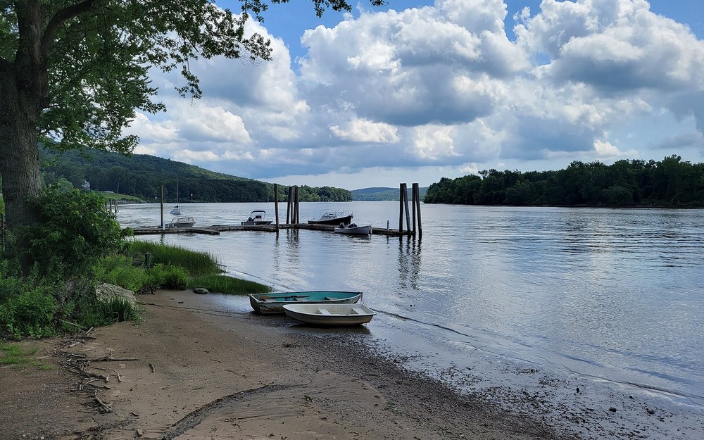
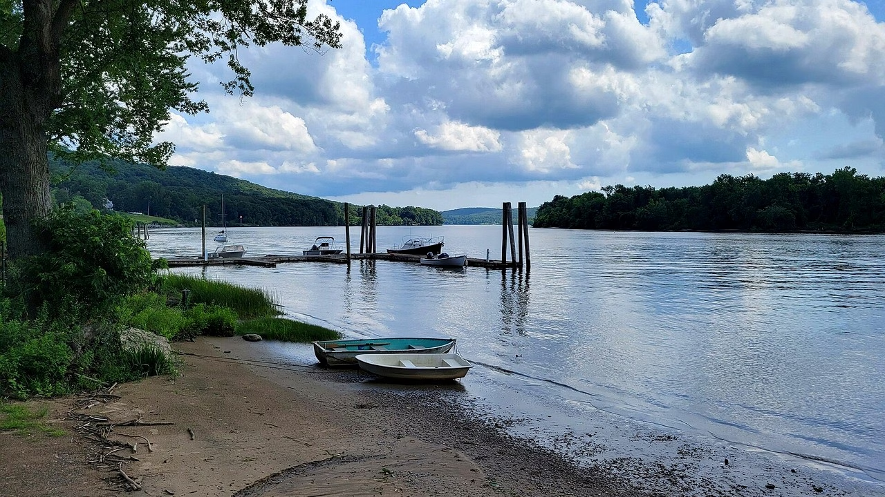
Photo: The tidal Connecticut River corridor around Haddam — deep outside channel scour holes, tributary coves, and rich current seams hosting 20- to 30+ pound channel catfish.
📍 Haddam Meadows State Park Boat Launch Haddam CT (GPS: 41.4820° N, 72.5080° W)
Target Species: Trophy Channel Catfish (10–30+ lbs C&R), Native White Catfish (to 12 lbs)
Productive Depth: 15–40 ft mainstem outside bends, bridge piling scour & Salmon River cove edge
Prime Structure: Tidal current seams, rock wing dams, submerged timber ledges, cove drop-offs
Top Bait: Fresh cut Atlantic menhaden (bunker), cut white perch, American eel chunks
Angler Field Log: The final two hours of an outgoing ebb tide past Haddam Neck turn Salmon River Cove’s outer drop-off into an ambush conveyor belt. Anchor your bow squarely on the 14-foot edge where dark marsh water dumps out into the 32-foot main river channel, drop 4- to 6-ounce flat bank sinkers baited with oiled bunker bellies, and wait for big white and channel cats stacked right along the temperature seam.
From the Charter Oak Bridge corridor in Hartford downstream forty miles through Middletown, Portland, East Haddam, and Deep River to Essex, the lower Connecticut River stands unchallenged as the heavyweight trophy belt among the best catfish fishing spots in Connecticut. Although the state’s official harvested channel catfish record remains perched at 23 pounds 4 ounces, tournament catch-and-release anglers fishing deep tidal holes between Wethersfield Cove and Haddam Meadows routinely net broad-headed mainstem bruisers tipping 25 to over 30 pounds—alongside dense schools of native white catfish reaching 8 to 12 pounds.
Because ocean tides drive measurable water-level swings all the way north to the Windsor Locks corridor, timing hydraulic flow separates slow days from double-digit hookups. Dead slack tide pauses scent dispersion almost completely; instead, focus boat anchoring and bank casts across active ebb or flood stages when three-knot flows funnel disoriented gizzard shad, silversides, and shrimp down gravel shelves. Key structure hubs include the rocky wing deflectors south of Middletown, the deep scour pockets under the Arrigoni and East Haddam Swing Bridges, the sheltered entrance of Wethersfield and Mattabesset Coves, and the fertile flats outside Haddam Meadows State Park and Salmon River Cove.
Managing three knots of reversing current takes purposeful terminal hardware and accurate weight selection. Use our Catfish Sinker Weight & River Current Calculator before heading out: moderate neap tides fish well with 3- to 4-ounce flat bank leads, whereas spring moon ebb flows often call for 5- to 6-ounce pyramid weights tied onto a standard sliding sleeve above a 120-pound swivel and 28-inch 40-pound mono shock leader. Always inspect knots carefully after every fish—submerged sharp zebra-mussel colonies blanket Connecticut River bridge riprap and easily shred light fluoro if you don’t check abrasion.
Public access up and down the lower river makes both shore and trailer campaigns simple. Shoreline anglers enjoy generous bank room right along Haddam Meadows State Park’s grass flats, Eagle Landing State Park, and the Middletown Harbor boardwalk, while trailered boats launch seamlessly at the concrete DEEP ramps inside Haddam Meadows, Salmon River Launch in East Haddam, and Harbor Park. Pack fresh whole Atlantic menhaden bought from shoreline bait shops (never harvest protected river herring inland) and slice 2-inch chunks straight through the backbone so natural bunker oils pulse smoothly downcurrent.
2. Candlewood Lake: Squantz Cove & Danbury Arm (Fairfield & Litchfield Counties)
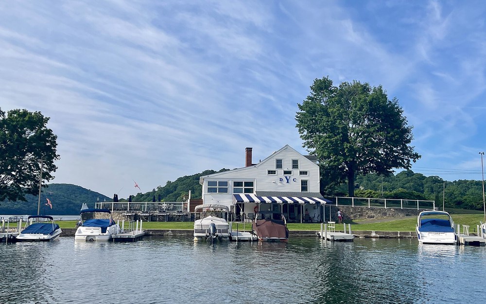
Photo: The southern Danbury basin of Candlewood Lake — 5,420 acres of flooded stone walls, sunken roadbeds, and deep rock ledges holding chunky white and channel catfish.
📍 Lattins Cove State Boat Launch Danbury CT (GPS: 41.4640° N, 73.4560° W)
Target Species: White Catfish (3–10 lbs), Channel Catfish (5–18 lbs), Brown Bullhead
Productive Depth: 12–32 ft off stone wall shelves, Squantz weed edges & pump canal ledges
Prime Structure: Submerged 1920s stone farm walls, gravel points, Eurasion milfoil borders
Top Bait: Fresh cut white perch, yellow perch fillets, garlic nightcrawlers, cut smelt
Angler Field Log: Weekend ski-boat traffic churns Candlewood into washing-machine chop until dusk, which quietly triggers phenomenal midnight white catfish feeds. Slide into Squantz Cove’s quieter western shelf or the northern Rocky River pump-station canal as wake boats pull onto trailers, anchor near 18 feet of water bordering old rock walls, and hang whole freshly cut white perch just six inches off bottom on glowing bobber-pegged Santee rigs.
Covering 5,420 surface acres across five municipalities in western Connecticut, Candlewood Lake is the state’s largest body of water—flooded in 1928 by pumping Housatonic River flow uphill into an entire valley of farms, orchards, and rock walls. Famous nationwide as a trophy smallmouth and largemouth bass arena, Candlewood quietly sustains one of southern New England’s healthiest, least-targeted populations of 3- to 10-pound white catfish and robust channel catfish fed continuously on landlocked alewives and booming white perch schools.
Because Candlewood lacks natural river currents through its broad open bays, locating productive catfishing terrain requires reading bottom hardness and submerged relic structures. Our summer night side-scan tracks consistently light up stacked catfish arches along three primary zones: the muddy-gravel transitions inside Squantz Cove on the northwest arm, the rocky point drops bordering Pine Island and Vaughan’s Neck in the Danbury southern basin, and the northern Rocky River discharge bay near New Milford where pump-back operations pulse cool, oxygenated Housatonic water into the lake.
Clever Candlewood regulars outfish weekend drifters by exploiting vertical elevation above milfoil beds and ancient fieldstones. Rather than burying bait directly into thick bottom moss where crawfish strip hooks silently, rig an elevated Santee Cooper setup anchored with a 1.5- to 2.5-ounce flat no-roll sinker paired with a 20-inch fluorocarbon leader and a buoyant 2-inch rattle float. Using thin low-visibility 20- to 25-pound fluorocarbon leaders pays serious dividends here because Candlewood’s water clarity frequently clears beyond 8 to 10 feet during midsummer dog days.
Plan launches carefully to beat crowded summer boat ramps and parking caps. Lattins Cove State Boat Launch on the Danbury end and Squantz Pond Launch to the north provide wide concrete ramps, while bank anglers find prime dusk seating along the southern Danbury Town Park margins and Squantz Causeway rocks (always obeying town parking stickers during peak daytime hours). Fish fresh cut white perch caught on light jigs right off your boat—Candlewood perch grow thick, oily fillets that stay pinned on 5/0 circle hooks hour after hour.
3. Lake Zoar: Shepaug Dam Tailrace to Kettletown (New Haven & Fairfield Counties)
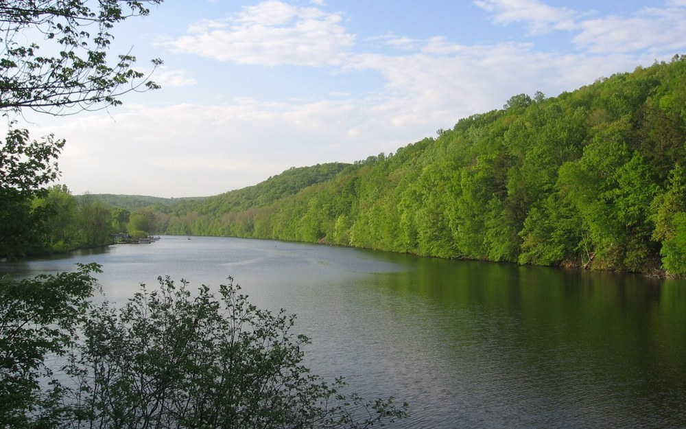
Photo: The steep forested gorge of Lake Zoar along the Housatonic corridor — sunken channel shelves, hydro generation seams, and productive Kettletown coves.
📍 Lake Zoar State Boat Launch Southbury CT (GPS: 41.4280° N, 73.2040° W)
Target Species: Channel Catfish (4–20 lbs), White Catfish (2–8 lbs), Yellow Bullhead
Productive Depth: 15–38 ft drowned Housatonic channel ledges, Kettletown creek mouth & dam tailwater
Prime Structure: Steep rocky canyon shelves, sunken bridge footings, Pomperaug River inlet flats
Top Bait: Cut Atlantic bunker, fresh white perch chunks, salted smelts, chicken liver in mesh
Angler Field Log: Lake Zoar switches into overdrive the exact minute Shepaug Dam turbines open upstream to generate afternoon peaking power. Position just downcurrent of the Pomperaug River mouth or along Kettletown’s steep eastern drop-offs before water pulses begin—dislodged crawfish and stunned alewives wash straight along the 22-foot channel shelf where 10- to 16-pound channel cats wait single-file behind sunken boulders.
Stretching ten winding miles down the Housatonic Valley from the base of Shepaug Dam to Stevenson Dam at Route 34, 909-acre Lake Zoar blends deep canyon impoundment depths with raw tailrace current dynamics whenever hydro turbines cycle water downstream. That daily pulse of oxygenated current fuels blistering growth rates among Zoar’s channel catfish and white catfish, turning steep wooded bends from Newtown across to Southbury and Oxford into dependable twilight action stretches.
Unlike wide shallow northern ponds, Zoar behaves like a sunken Appalachian river gorge. The old Housatonic riverbed carves 30- to 45-foot contours tight against sheer rock bluffs on outside corners, punctuated by shallow boulder bars and sediment-rich tributary deltas like Halfway River and the Pomperaug River inflow. When hydro generation slackens at dusk, baitfish drift out across the flatter cove entrances of Kettletown State Park and Eichler’s Cove; when water surges cleanly below Shepaug Dam, predator catfish hug bottom eddies directly behind downstream gravel bars and submerged crib structures.
Heavy timber snags and craggy quarry rock lining Lake Zoar make abrasion insurance mandatory. Load sturdy baitcasting or 5000-size spinning reels with 50- to 65-pound braided mainline calculated smoothly via our Reel Line Capacity & Backing Calculator, tied down to a 24-inch section of 40-pound monofilament abrasion leader. Fish 2- to 4-ounce flat bank sinkers depending on whether Shepaug Dam turbines are idling or pumping full head, and peg a small float 5 inches behind 6/0 inline circle hooks so baits hover above crevice-dwelling crayfish.
Boating anglers launch cleanly at the Lake Zoar State Boat Launch off Lakeside Road in Southbury, while foot-access anglers score steady dusk bites directly from the rocky shoreline ledges along Kettletown State Park (note standard Connecticut park walk-in/parking protocols). One critical local stewardship rule: keep no catfish harvested from Lake Zoar if you wish to follow strict CT Department of Public Health (DPH) PCB fish consumption advisories on the Housatonic River system—practice clean catch-and-release fishing with barbless/non-offset circle hooks so Zoar’s heavy breeding stock keeps thriving.
4. Lake Lillinonah: Lovers Leap Gorge & Shepaug Arm (Litchfield, New Haven & Fairfield Counties)
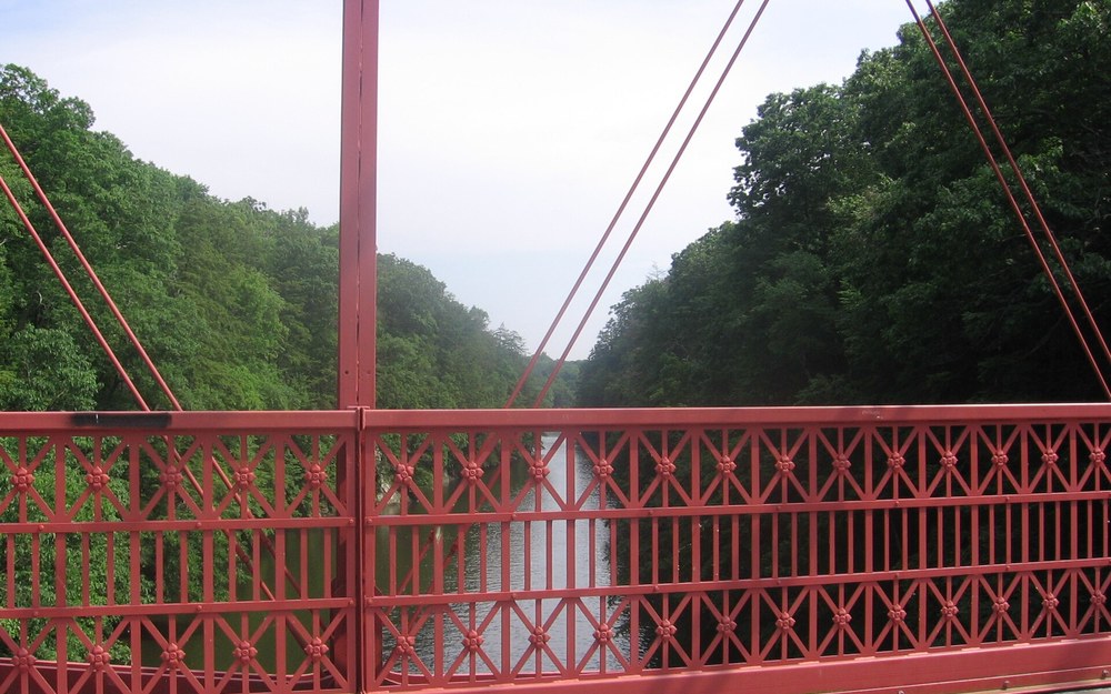
Photo: The dramatic Lovers Leap Gorge on Lake Lillinonah — steep bedrock walls plunging straight into 35+ foot catfish travel lanes in western Connecticut.
📍 Pond Brook State Boat Launch Newtown CT (GPS: 41.5120° N, 73.3850° W)
Target Species: Heavy Channel Catfish (5–18+ lbs), White Catfish (2–9 lbs)
Productive Depth: 14–35 ft along Lovers Leap gorge ledges, Shepaug Arm timber & Pond Brook bay
Prime Structure: Flooded bedrock cliff drop-offs, tributary creek mouths, sunken timber piles
Top Bait: Fresh cut Atlantic menhaden, cut white perch, chicken liver, nightcrawler clusters
Angler Field Log: The Shepaug River Arm jutting north off Lake Lillinonah is an understated summer goldmine. After dark, run quietly up into the tree-lined narrows past the Rt. 133 bridge, anchor near a sharp outside timber curve reading 16 to 22 feet deep, and fan three 7/0 circle rigs tipped with freshly sliced bunker out across the flooded creek channel—heavy double-headers here regularly hit within twenty minutes of anchoring.
Immediately upstream of Shepaug Dam and wrapping twelve rugged miles north past New Milford, 1,547-acre Lake Lillinonah forms Connecticut’s second-largest waterbody and an undeniable heavyweight factory for dark, broad-shouldered Housatonic channel cats. Framed by Lovers Leap State Park’s dramatic stone bridge gorge and towering hemlock cliffs, Lillinonah offers deep rocky contours and fertile mud-arm bays stocked richly with white perch, alewives, and sunfish.
Lillinonah’s fish migrate sharply along its unique L-shaped topography. During spring warming from late April into June, pre-spawn catfish invade shallower muddy creek arms—especially the sweeping Shepaug River Arm bordering Roxbury/Washington and the sheltered Pond Brook inlet off Newtown—hunting crawfish and winter-kill alewives across 8- to 16-foot flats. By midsummer, warm surface layers push big fish back onto deeper 20- to 35-foot gorge ledges beneath Lovers Leap Bridge and along the steep northern main-lake points where deep water meets shaded vertical cliffs.
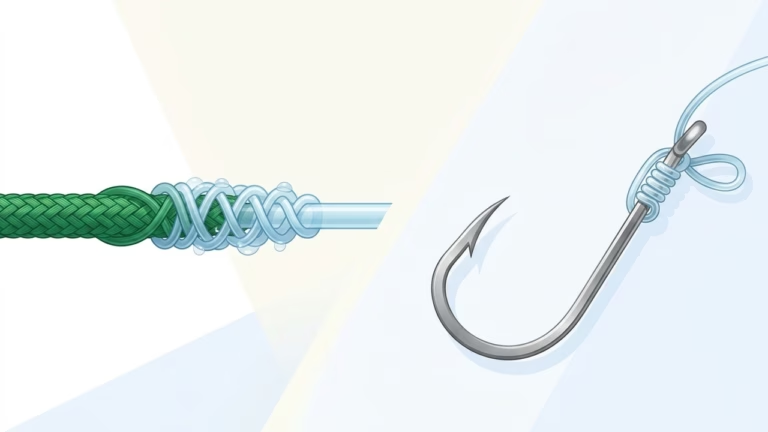
Tactically, anchoring safely on Lillinonah means respecting occasional timber debris carried down from upper Housatonic storms and matching sinker shapes to steep rocky slopes. Round egg leads tend to roll straight down Lillinonah’s 45-degree ledges into crevice snags; swap immediately to 2- or 3-ounce flat no-roll sinkers paired with a clean FG or Palomar knot verified via our Fishing Knot Strength & Line Matcher. If biting fish show hesitation under clear post-cold-front skies, drop bait size down to 1-inch strip cuts of fresh white perch to turn finicky white cats into consistent hooksets.
Boat access centers cleanly on the concrete Pond Brook State Boat Launch off Hanover Road in Newtown and the Route 133 (Bridgewater/Brookfield) DEEP Launch further north. Shore anglers gain reliable bank footing beneath Lovers Leap State Park’s historic bridge ledges, where deep water sits within easy casting range right off rocky outcrops. Just remember the same Housatonic DPH PCB catch-and-release stewardship rule applies across Lillinonah’s mainstem waters: photograph your trophies quickly over wet mats and glide them safely back into the gorge.
5. Quinebaug River & Wauregan Reservoir: Killingly / Danielson Reach (Windham County)
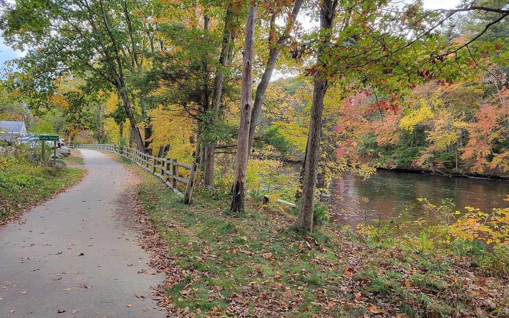
Photo: The lush eastern corridor of the Quinebaug River near Danielson — shaded mill-pond eddies, slow gravel bends, and historic state-record catfish territory.
📍 Quinebaug Pond Wauregan Reservoir Boat Launch Killingly CT (GPS: 41.7850° N, 71.8860° W)
Target Species: Channel Catfish (4–23+ lbs State Record Lineage), Brown Bullhead
Productive Depth: 6–22 ft Wauregan stump basin edges, Danielson bridge bends & dam millraces
Prime Structure: Historic mill dam aprons, sunken root wads, shallow vegetated clay bends
Top Bait: Whole nightcrawlers, cut bluegill/perch, scented chicken liver, sweet corn-dough
Angler Field Log: Eastern Connecticut quietly holds state-record channel cat genetics thanks to decades-old plantings anchored in Wauregan Reservoir (Quinebaug Pond) just outside Danielson. Drift quietly by kayak or jon boat along the southern stump cove edges around twilight, anchoring tight to deadwood points with 1.5-ounce no-roll weights loaded with fresh perch strips or garlic-cured liver.
Eastern Connecticut’s sleepy Windham County watershed carries undeniable trophy royalty in state fishing archives: Wauregan Reservoir (locally known as Quinebaug Pond) right outside Danielson produced Connecticut’s official 23 pound 4 ounce harvested state-record channel catfish, alongside ongoing stocks seeded by CT DEEP across the Quinebaug River corridor stretching downstream toward Brooklyn and Plainfield. Far removed from noisy suburban boat ramps, this rural eastern river valley rewards stealthy kayak crews and classic dawn-to-dusk shore anglers.
Quinebaug River catfishing splits naturally between slow, deeply undercut main river oxbows near Danielson and Wauregan Reservoir’s 150-acre shallow stump basin fed cleanly by groundwater and small feeder brooks. Along the main Quinebaug, focus on outside river curves where slow muddy waters scour out 10- to 15-foot holes beneath overarching maples and fallen willow root wads, plus the churned plunge aprons immediately below historic textile mill dams. On Wauregan Pond itself, stump rows bordering 8- to 18-foot main basin drop-offs attract cruising channel cats starting just before sunset.
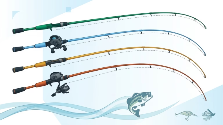
Light to medium-heavy tackle turns fighting fish along these modest, woody waters into exhilarating sport without overkill. A 7-foot medium-heavy baitcasting or spinning outfit matched carefully with our Rod Power, Action & Species Matcher handles 1- to 2-ounce egg weights effortlessly while carrying plenty of backbone to steer heavy channel cats away from drowned willow branches. Swap 8/0 monster hooks for sharper, compact 4/0 to 5/0 circle hooks that hide neatly inside fresh perch cut fillets or doubled-up nightcrawler clusters.
Wauregan Reservoir’s compact DEEP trailered/cartop ramp limits big horsepower traffic and keeps evening sessions blissfully glass-calm, while shoreline parks and bridge pull-offs flanking the Quinebaug River Trail near Danielson offer straightforward walk-in bank spots. Note CT DEEP’s special pond rules before harvesting: Wauregan Reservoir operates under heightened management restrictions at times—verify whether the 3-fish Catfish Management Lake cap applies before putting anything on a stringer.
6. Bantam Lake: North & South Bays (Litchfield County)
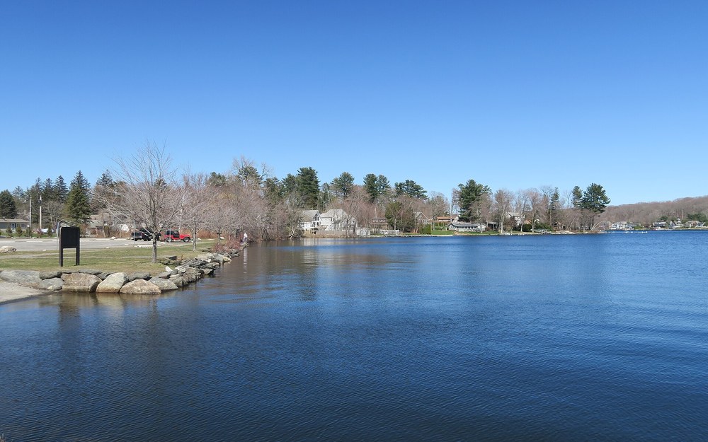
Photo: Bantam Lake in Morris and Litchfield — Connecticut’s largest natural glacial lake brimming with bullheads and white catfish across lush shallow flats.
📍 Bantam Lake Beverly Marina Boat Launch Morris CT (GPS: 41.7060° N, 73.2180° W)
Target Species: Trophy Brown & Yellow Bullhead (1–3+ lbs), Native White Catfish
Productive Depth: 6–18 ft Bantam River inlet flat, South Bay coontail beds & Marsh Point edges
Prime Structure: Organic mud bowls, submerged aquatic weed edges, gentle rock reefs
Top Bait: Nightcrawlers, garlic punch bait, mini cut perch strips, chicken liver
Angler Field Log: On warm May and June evenings when Bantam Lake’s shallow North Bay touches 68°F, you can anchor your skiff outside the White Memorial Foundation marsh reeds in just 7 feet of water and catch chunky 14-inch brown bullheads and white cats on virtually every cast using dual ultralight Carolina rigs tipped with sweet corn and lively red worms.
Spanning 947 scenic acres between Litchfield and Morris in the Litchfield Hills, Bantam Lake stands proudly as Connecticut’s largest natural glacial lake. Shallow, fertile, and ringed by sprawling wetlands within the White Memorial Conservation Center, Bantam lacks dramatic hydro canyon drops—maxing out near 25 feet—yet serves up unmatched non-stop numbers of fat brown bullheads, yellow bullheads, and native white catfish ideal for relaxed evening boats and family shore outings.
Because sunlight penetrates deep into Bantam’s broad North and South Bays, lush beds of coontail, milfoil, and wild celery carpet its perimeter out to 10-foot contours. Catfish and bullheads avoid choking inside thickest mid-afternoon weeds, staging instead right along muddy transitional channels where Bantam River enters North Bay and across gentle gravel-silt drop-offs around Marsh Point and South Bay’s southern weed edges. Once twilight shadows settle over the water, hungry schools slide boldly up onto 5- to 8-foot mud flats to vacuum up burrowing mayfly nymphs, snails, and sluggish shiners.
Leave heavy surf-style leads in the truck when rigging for Bantam. Delicate 0.5- to 1-ounce sliding egg weights threaded on 12- to 15-pound monofilament with size 2/0 to 4/0 light-wire octopus hooks prevent weights from sinking straight out of sight into North Bay’s plush organic silt. Alternatively, floating baits 18 inches beneath lighted slip bobbers right along outer weed edges works brilliantly whenever bottom moss tries to swallow sunken worms.
Launch seamlessly from the South Shore State Boat Launch off Beverly Marina / East Shore Road in Morris or rent small skiffs locally during season; shore and canoe anglers also enjoy tranquil evening access along White Memorial marsh bridges and public park strips. Bear in mind that Connecticut does not apply a statewide daily creel cap to native Brown or Yellow Bullheads, making Bantam Lake a classic traditional fish-fry spot for crispy spring bullhead fillets while preserving larger channel cats elsewhere.
7. Thames River Estuary & Norwich Harbor Confluence (New London County)
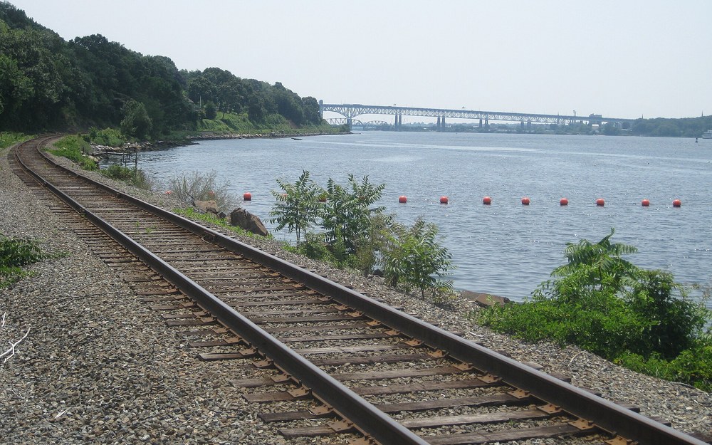
Photo: Looking north along the tidal Thames River toward Norwich Harbor — brackish pilings, Shetucket-Yantic eddies, and prime tidal white catfish structure.
📍 Howard T Brown Memorial Park Boat Launch Norwich CT (GPS: 41.5220° N, 72.0780° W)
Target Species: White Catfish (2–9 lbs), Brackish-Tolerant Channel Catfish
Productive Depth: 12–30 ft Norwich Harbor turning basin, Shetucket mouth & Uncasville bends
Prime Structure: Bulkhead seawalls, shipping pilings, Yantic & Shetucket freshwater plumes
Top Bait: Cut Atlantic bunker, squid strips, sandworms, fresh white perch chunks
Angler Field Log: The upper Thames Estuary around Norwich Harbor sits squarely where clean freshwater outflows from the Yantic and Shetucket rivers clash with rising Long Island Sound salinity. Post up right beside Howard T. Brown Park’s bulkhead during the final three hours of an outgoing tide when fresher, less salty water washes back past Harbor pilings—fat white catfish cruise that bottom halocline boundary all summer.
Forged dramatically at Norwich where the Yantic and Shetucket rivers collide, the 15-mile Thames River Estuary forms a deep, brackish coastal shipping channel running south through Montville and Groton straight into Long Island Sound. While saltwater anglers crowd its lower reaches near New London for bluefish and striped bass, the upper freshwater-dominated third from Norwich Harbor down past Trading Cove and Stoddard Hill quietly supports prolific concentrations of hefty tidal white catfish alongside opportunistic estuary channel cats.
White catfish thrive uniquely in slightly brackish waters (tolerating up to 10–14 parts per thousand salinity effortlessly), shifting vertically and horizontally alongside incoming saltwater wedges. During incoming flood tides, saltier dense water pushes catfish tight up into the shallower upper Norwich Harbor turning basin and directly into the Yantic and Shetucket tributary mouths. As outgoing tides pull freshwater downward past Mohegan Park and Trading Cove, fish drop onto 15- to 28-foot shelf drops lining old timber pilings and deep riprap corners.
Important regulatory boundaries slice squarely across the upper Thames watershed—pay strict attention to licensing and rod limits! Waters south of the inland/marine demarcation line in Norwich fall under CT DEEP’s Marine District jurisdiction, which limits anglers cleanly to two lines/rods per person instead of three inland rods, and requires proper Connecticut Saltwater/Marine Registry coverage (usually bundled cleanly into Resident All-Waters combinations, or verified on your DEEP portal before casting). Rinse anodized reels and stainless swivels with freshwater after every Thames estuary outing to halt brackish salt corrosion.
Howard T. Brown Memorial Park right in downtown Norwich provides illuminated harbor bulkheads, clean dockside parking, and a paved boat launch overlooking the Yantic/Shetucket convergence. Boaters can also launch cleanly five miles downriver at Stoddard Hill State Park in Ledyard to soak oily Atlantic bunker or salted squid strips beside quiet Trading Cove eddies away from commercial tugboat traffic.
8. Lower Housatonic River: Derby Dam Tailrace to Sunnyside & Milford (New Haven & Fairfield Counties)
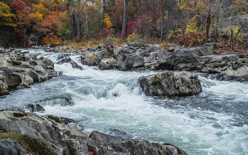
Photo: Housatonic River rocky tailwater pockets and current seams — classic catfish ambush structure downstream below hydro dams down through Shelton and Sunnyside.
📍 Sunnyside Boat Ramp Shelton CT (GPS: 41.2980° N, 73.0850° W)
Target Species: Channel Catfish (5–18 lbs), Native White Catfish (3–9 lbs)
Productive Depth: 8–26 ft Derby Dam tailrace rock pools, Naugatuck seam & Sunnyside channel bend
Prime Structure: Spillway current boils, bridge abutments, Naugatuck River confluence mud bars
Top Bait: Fresh cut Atlantic menhaden, clam strips, cut white perch, whole squid
Angler Field Log: The sweeping tidal stretch running south from the Naugatuck River confluence past Sunnyside Boat Ramp in Shelton acts as a two-way feeding corridor. Drop 4-ounce flat bank sinkers loaded with bloody Atlantic bunker along the shaded 18-foot channel wall opposite Sunnyside as late-afternoon ebb tides align with upstream dam releases—big white cats and husky channels intercept scents sweeping miles downstream.
Below the historic Derby-Shelton Dam (Lake Housatonic spillway), the Housatonic River shakes off upper canyon reservoirs and flows twelve tidal miles through Shelton, Derby, Orange, and Stratford before opening onto Long Island Sound. From the boulder-strewn Derby Dam tailrace down past the Naugatuck River seam, Wooster Island backwaters, and Sunnyside Boat Ramp, this urban-accessible estuary holds dense, under-fished populations of both tidal channel catfish and heavy white catfish.
Hydraulic mixing defines fish location throughout this lower stretch. Right below the Derby spillway and Route 8 bridge piers, swirling freshwater boils oxygenate shallow rock pools and concentrate stressed hickory shad, white perch, and resident forage species during May through August. Two miles south, the murky Naugatuck River pours in alongside Shelton’s sweeping river bends, creating dramatic slack-water gravel bars and 20-foot outside channel scour holes around Wooster Island and Sunnyside where resting catfish stack tight out of main shipping currents.
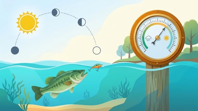
Because bottom surfaces here shift wildly from jagged granite tailrace rocks near Derby to soft tidal silt and shellbeds south of Shelton, smart terminal selection limits costly snags. Pair heavy 3- to 5-ounce flat bank or storm sinkers (never round balls on granite ledges!) with 40-pound monofilament snelled leaders and non-offset 6/0 circle hooks. Schedule shore or skiff campaigns directly around rising or falling lunar current shifts plotted via our Solunar Bite Times & Barometric Forecaster—combining an outgoing afternoon tide with a dropping barometer frequently sets off non-stop bites all evening.
Access couldn’t be easier along either shore: trailer boaters launch directly at the wide, well-maintained Sunnyside Boat Ramp off River Road in Shelton, while shore casters fish open riverside lawns at Indian Well State Park, Shelton Riverwalk, and Derby Greenway parks. Like all Housatonic River segments statewide, verify current CT DPH fish consumption advisories before planning a harvest (and note the Marine District two-rod limit south of the tidal boundary near Derby/Shelton).
Connecticut Catfish Species Profile: Identifying Your Target Quarry
Before adjusting hook sizing or logging catches for state recognition, it pays to cut cleanly through New England fishing dock myths. Unlike southern waters across Virginia or Pennsylvania, blue catfish and flathead catfish do not maintain established wild breeding populations in Connecticut. Instead, Connecticut’s inland lakes and tidal estuaries are ruled by three resilient, distinct whiskerfish species—each carrying unique habitat tolerances, forage preferences, and state record benchmarks:
- Channel Catfish (Ictalurus punctatus): Connecticut’s undisputed freshwater heavyweight (Official Harvested Record:
23 lbs 4 ozfrom Wauregan Reservoir, though30+ lbcatch-and-release titans are caught regularly in the Connecticut River). Recognized cleanly by its deeply forked tail fin with pointed tips, curving rounded anal fin sporting24 to 29 rays, and olive-bronze or slate-gray sides (scattered black spots vanish on giant adults over 10 pounds). Feeds aggressively along current seams, gravel shelves, and deep hydro-dam bends on bunker, white perch, liver, and worms. - White Catfish (Ameiurus catus): A native East Coast powerhouse anchoring tidal rivers and warm reservoirs statewide (State Record:
12 lbs 12 ozfrom the Connecticut River). Frequently mistaken for channel cats until you inspect two telltale features: a distinctly rounded-lobe, moderately forked tail (never sharp pointed tips) and a shorter rounded anal fin holding only19 to 22 rays, paired with a broader flattened head and pale slate-blue coloration. Fiercely brackish-tolerant across both the Thames and Lower Housatonic estuaries. - Brown & Yellow Bullhead (Ameiurus nebulosus / natalis): Widespread across glacial ponds, Bantam Lake bays, and quiet Connecticut River coves (State Record:
4 lbs 6 ozBrown Bullhead). Instantly separated from channel and white catfish by a square or slightly notched unforked tail fin. Brown bullheads wear mottled olive-brown hides and dark chin barbels, whereas yellow bullheads display golden-olive flanks and telltale pale cream-white chin whiskers. Excluded from Connecticut’s 6-fish catfish creel aggregate!
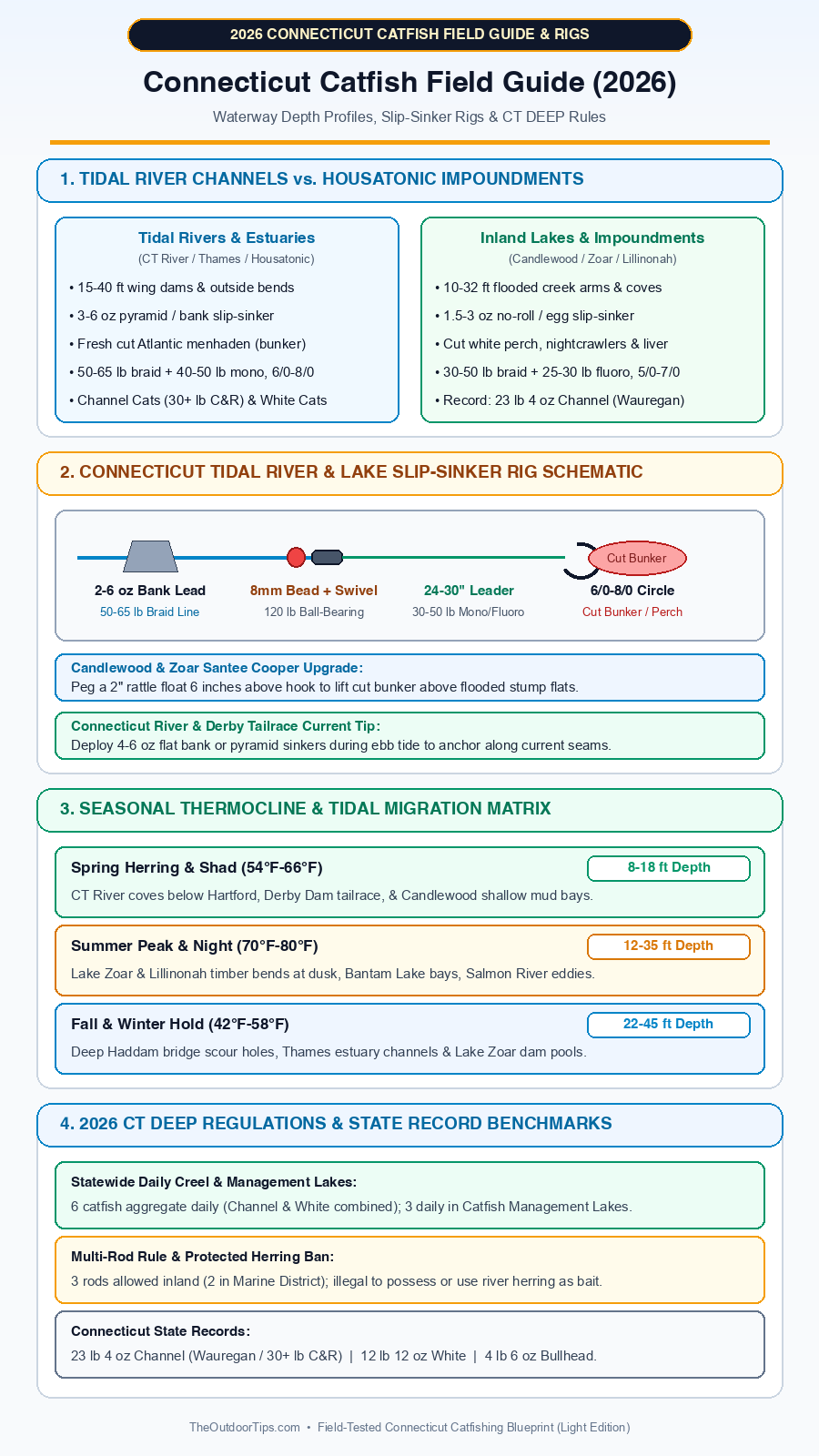
Click the high-resolution Connecticut Field Guide Blueprint above to save and reference depth bands, slip-sinker layouts, and 2026 CT DEEP regulations waterside.
Heavy Terminal Tackle, Tidal Slip-Sinker Rigs & Connecticut Gear Guide
Rigging effectively across Connecticut demands two distinct blueprints engineered for opposing bottoms: a current-locking Tidal Bank / Pyramid Slip-Sinker Rig built to anchor baits cleanly through three-knot Connecticut and Thames tides, and an elevated Santee Cooper Stump-Runner Rig designed to keep cut white perch suspended high above Candlewood boulders, Zoar stumps, and Bantam silt.
Watch how tournament river anglers build clean sliding sinker rigs, protect knots with shock beads, and hold heavy baits steady along tidal current seams.
For Connecticut, Thames & Lower Housatonic Tidal Rivers, thread a heavy 3- to 6-ounce flat bank sinker or storm/pyramid lead (via a rugged plastic sinker slide) onto 50- to 65-pound braided mainline, buffer the line knot with an 8mm soft rubber bead, and tie directly to a 120-pound ball-bearing swivel. Follow with 24 to 30 inches of abrasion-tough 40-pound monofilament leader snelled tightly onto a forged 6/0 to 8/0 non-offset inline circle hook. Keeping lead weight sliding freely ensures wary tidal channel cats turn cleanly off bottom without feeling sinker resistance, locking the circle hook squarely into the jaw hinge as your rod tip bends smoothly downward.
For Candlewood Lake, Lake Zoar & Lake Lillinonah Impoundments, convert that identical sliding base into a snag-defeating Santee Cooper Float Rig. Drop sinker weight down to 1.5–3 ounces of flat no-roll lead, tie on 24 inches of low-vis 25- to 30-pound fluorocarbon or mono leader, and peg a 2-inch foam rattle float six inches above a 5/0–7/0 circle hook. That buoyant rattle suspends smelly cut white perch cleanly out of lakebottom weeds and flooded stump cracks while firing subtle hydro-acoustic clicks every time slow waves shift your rig.
Ugly Stik Catfish Special Casting Rod (7’6” Heavy)
Tough Ugly Tech E-glass/graphite composite blank heaves 5-ounce Haddam river sinkers effortlessly yet carries a glowing fast-telegraphing tip for shy Candlewood white catfish nibbles.
Abu Garcia Ambassadeur C3 6500 / Penn Battle IV 5000
High-torque drag stacks tame surging 25-pound Connecticut River channels in fast ebb tides while loud clicker alarms wake anchored crews during dead-night Lake Zoar drifts.
Top Connecticut Catfishing Bait Lineup (Legal Tidal Cut Bait vs. Lake Favorites)
Choosing productive scent baits in Connecticut requires matching forage to regional waters while staying strictly clear of protected spring herring bans. Cross-check commercial versus fresh natural setups in our Best Catfish Baits Guide and pack your cooler cleanly:
- Fresh Cut Atlantic Menhaden (Bunker): The undeniable gold standard across the Connecticut River, Thames Estuary, and Lower Housatonic—and legal year-round. Buy whole oily bunker from Long Island Sound coastal bait dealers, keep them packed hard on ice (never mushy), and slice firm 2×2-inch midsection chunks hook-pinned cleanly through the tough skin layer.
- Cut White Perch, Golden Shiners & Sunfish (Where Legal): Unbeatable on inland Housatonic impoundments like Candlewood Lake, Lake Zoar, and Lake Lillinonah where white perch form the dominant benthic meal. Always check CT DEEP rules before trapping or cutting local panfish—hooked chunks cut diagonally through the lateral ribs drip steady proteins across timber coves.
- Chicken Liver in Spawn Mesh & Garlic Dip Baits: Top choice for numbers fishing at Bantam Lake, Quinebaug River oxbows, and urban CT DEEP Catfish Management Lakes. Wrap cold chicken livers neatly inside nylon spawn-sac netting or fine gauze before sliding onto 4/0 circle hooks so forceful bank casts don’t fling liver into orbit.
- NEVER Use Protected River Herring (Alewife or Blueback Herring): Strict Connecticut law prohibits taking, possessing, or using anadromous river herring inland on streams and rivers (except specifically authorized landlocked exemptions clearly printed in DEEP code—don’t guess, leave all river herring swimming!). Stick strictly to marine Atlantic menhaden or store-bought baitfish.
Seasonal Hydrology, Tidal Exchange & Water Temperature Strategy Across Connecticut
Because New England weather flips dramatically from icy spring freshets to humid August heatwaves, positioning across Connecticut waters tracks predictable thermal bands and tidal phases:
- Spring Herring/Shad Pulse & Warming (Late April – May | 54°F–66°F): As snowmelt runoff subsides and coastal alewives and American shad funnel upriver past Haddam and Derby Dam, starving channel catfish pack inside warmer slack-water coves and tailrace rock pools. Work 8- to 16-foot cove mouths (Wethersfield Cove, Salmon River Cove, Bantam North Bay) during afternoon sun warming with bloody cut bunker and nightcrawlers.
- Summer Spawn & Nocturnal Thermocline (June – August | 70°F–80°F): Midsummer heat drives big reservoir catfish deep off daytime boat-choked flats onto shaded 20- to 35-foot gorge ledges in Lillinonah and Candlewood, then pushes active feeders shallow along creek points once jet-skis clear off the water after dusk. On tidal rivers, fish moving evening tides regardless of daylight clarity.
- Autumn Bunker Gorge & Reservoir Turnover (September – October | 52°F–68°F): Crisp September nights drop shallow bay temperatures rapidly, triggering aggressive fall feeding frenzies as juvenile menhaden migrate back toward Long Island Sound. Follow diving gulls and bait clouds down the Haddam to Essex river corridor and work deep timber bends on Lake Zoar before fall lake turnover temporarily scatters scents.
- Winter Cold-Water Hold (November – March | 36°F–46°F): Shallow glacial lakes freeze cleanly across Litchfield and Windham counties, pushing sluggish catfish into hibernation-like deep basin dormancy. However, fast-moving sections of the lower Connecticut River around Haddam Neck and deep Thames shipping channels frequently stay ice-free—soak small, scent-soaked strips of fresh bunker patiently in 30- to 45-foot bridge holes during bright midwinter thaws.
2026 CT DEEP Regulations, Catfish Management Lakes & AIS Boat Decal Rules
⚠️ 2026 Connecticut DEEP Compliance & Boating Checklist
Before trailering boats or keeping catfish in Connecticut, double-check all current water-specific notices in the official Connecticut DEEP Freshwater Fishing Guide:
- Statewide Daily Creel & Catfish Management Lakes: Statewide inland waters enforce a 6 catfish daily aggregate limit (Channel Catfish and White Catfish combined, zero minimum size). However, inside designated CT DEEP Catfish Management Lakes (stocked urban/community ponds plus select special waters), the daily creel limit drops strictly to 3 catfish per angler per day. Brown and Yellow Bullheads carry no statewide daily harvest limit.
- 3 Rods Inland vs. 2 Rods in Marine District: Holders of a standard Connecticut inland fishing license may legally tend up to 3 rods/lines simultaneously across inland lakes and non-marine river reaches. Note sharply that once you cross south below demarcation lines on the lower Thames, Connecticut, or Housatonic estuaries into the Marine District, gear drops strictly to 2 rods per angler and requires Marine Waters licensing/registry coverage.
- Protected River Herring Possession Ban: Connecticut law strictly enforces a closed season and zero-possession ban on anadromous river herring (alewives and blueback herring) statewide. Never cast-net, retain, or slice river herring from any Connecticut stream or river—stick strictly to marine Atlantic menhaden (bunker), store-bought shiners, or legal inland panfish where permitted.
- AIS Boat Decal, Safe Boating Certificate & Housatonic PCB Advisories: Every Connecticut registered vessel operating on inland waters (plus out-of-state trailered boats launching on CT freshwaters) requires a valid Connecticut Aquatic Invasive Species (AIS) Stamp/Decal alongside a recognized Safe Boating Certificate, and thorough zebra-mussel clean-drain-dry decontamination when transferring between the Housatonic watershed and eastern ponds. Additionally, verify CT DPH PCB Fish Consumption Advisories across the Housatonic River (Lillinonah, Zoar, Lower Housatonic) and practice safe catch-and-release there.
Interactive Fishing Tools & Calculators Hub
Fine-tune heavy sinker weights against Connecticut River ebb tides, verify backing yardage before spooling deep Housatonic braids, and test knot strength ratings prior to midnight hookups:
⚓ Sinker Weight & River Current Matcher
Calculate exact pyramid and flat bank lead weights needed to lock baits down against 3-knot Connecticut and Thames river ebb flows.
🔄 Reel Line Capacity & Backing Calculator
Compute precise mono backing yardage for loading 50–65 lb braid onto Ambassadeur C3 6500 or Penn Battle 5000 reels.
🧲 Fishing Knot Strength & Line Matcher
Compare Palomar, Snell, and FG knot efficiency ratings for braid-to-mono shock leaders over sharp zebra-mussel ledges.
🎯 Rod Power, Action & Species Matcher
Interactive rod finder balancing Bantam bullhead finesse setups against heavy Haddam tidal river trophy sticks.
🌙 Solunar Bite Times & Barometric Forecaster
Synchronize Long Island Sound tidal charts with lunar feeding peaks and cold-front pressure drops before launching.
🦐 Best Catfish Baits: Live vs. Cut Showdown
Compare fresh Atlantic menhaden, cut white perch, chicken liver in mesh, and punch baits across seasonal temperatures.
✅ Final Captain’s Verdict: Cracking Connecticut Catfish in 2026
1. Target True State-Caliber Giants Down the Mainstem: Launch at Haddam Meadows or anchor along Salmon River Cove on an outgoing evening ebb tide armed with 5-ounce flat bank sinkers, 65-pound braid, and fresh cut Atlantic bunker—that single river stretch gives you your sharpest shot at Connecticut’s heaviest 20- to 30+ pound channel cats.
2. Fish Midnight Housatonic Impoundment Structure: Let weekend wake boats clear off Candlewood Lake, Lake Zoar, and Lake Lillinonah, then anchor over 16- to 28-foot drowned channel shelves with pegged Santee rattle floats and cut white perch for non-stop big-fish hookups (and release all Housatonic catches safely).
3. Load Fast Evening Stringers Out North & East: Hit Bantam Lake for high-action bullheads or explore historic Quinebaug River / Wauregan Reservoir shores at dusk where quiet oxbows and light slip-sinkers keep beginners and veteran shore anglers hooked up till midnight.
Frequently Asked Questions About Catfishing in Connecticut
Where is the #1 best place to catch big catfish in Connecticut?
The tidal Connecticut River stretch from Hartford down through Middletown, Haddam Meadows, and Salmon River Cove produces the largest channel and white catfish in the state, regularly turning out 20- to 30+ pound catch-and-release channel cats alongside 8- to 12-pound native white catfish. Inland, Lake Lillinonah, Lake Zoar, and Wauregan Reservoir (home of the 23 lb 4 oz harvested state record) rank right behind it.
What is the daily bag limit for catfish in Connecticut in 2026?
Under 2026 CT DEEP regulations, anglers may keep up to 6 catfish per day in aggregate (Channel Catfish and White Catfish combined) on general inland waters with no minimum length limit. Inside designated CT DEEP Catfish Management Lakes, the daily creel drops strictly to 3 catfish per day. Brown and Yellow Bullheads have no statewide creel limit.
How many fishing rods can you use for catfish in Connecticut?
A licensed Connecticut angler may fish up to 3 lines/rods simultaneously on inland freshwater rivers, ponds, and impoundments (including Candlewood, Zoar, Lillinonah, Bantam, and upper Quinebaug). Once entering the brackish Marine District south of demarcation lines on the lower Connecticut, Thames, or Housatonic rivers, the maximum drops strictly to 2 rods per angler.
Are there flathead or blue catfish in Connecticut?
No. Unlike southern states, neither flathead catfish nor blue catfish have established wild reproducing populations in Connecticut waters. Connecticut’s catfishing is anchored entirely by trophy Channel Catfish, brackish-tolerant native White Catfish, and prolific Brown and Yellow Bullheads.
Can I catch and use river herring (alewives) as catfish bait in Connecticut?
No. Connecticut enforces a strict statewide ban prohibiting the taking, possession, or use of anadromous river herring (alewife and blueback herring) from inland rivers and streams. Instead, use legal marine Atlantic menhaden (bunker) purchased from coastal tackle shops, legal store-bought shiners, cut white perch, or chicken liver.
Should I eat catfish caught in the Housatonic River lakes like Zoar and Lillinonah?
Always verify current CT Department of Public Health (DPH) PCB Fish Consumption Advisories before eating any Housatonic River fish. Because bottom-feeding catfish accumulate legacy PCBs higher along Housatonic waters (Lake Lillinonah, Lake Zoar, and the Lower Housatonic below Derby), seasoned guides strongly advise strict catch-and-release across the entire Housatonic chain.
Do I need an AIS Decal to launch my boat on Connecticut catfish lakes?
Yes. Any registered vessel (including out-of-state trailered boats) launched onto Connecticut inland freshwaters requires a valid Connecticut Aquatic Invasive Species (AIS) Stamp/Decal, and operators must carry a valid Safe Boating Certificate plus thoroughly inspect, drain, and dry hulls to halt zebra mussel transfer out of the Housatonic basin.